Certainly won’t help their cause but financial news today will have bigger impact the other way imo
Krugman hit the nail on the head today. Anyone who willingly votes for some form of currency union without political union in light of what we have seen in the eurozone in the last few years needs their head examined.
The biggest lie of all is that the oil is running out. The Scots are finally waking up to the realisation that London is bullshitting them and have actively put obstacles in the way of finding more oil by dumping munitions in the middle of drilling fields to stop the oil companies.
The vote is for over 16’s and all young people are voting yes. A strong Rangers fan call could galvanise a no vote but loads of those fan clubs have fallen away with the last few years with the turmoil in the club.
I fear and hope Raymond has called this too early and called it wrong…
SCOTLANDS ATLANTIC MARGIN and ESTUARY RESERVES.
Bill “Big Mac” McLaughlin worked as a consultant to industry, he has also worked in higher education. He is now retired but retains an active interest in all matters relating to Scottish oil and gas. He is particularly interested in ensuring that the TRUE extent of Scotland’s oil and gas reserves both onshore and offshore and this includes ensuring that Westminster is not allowed to carry out another McCrone style burying of the FACTUAL EXTENT of Scotland’s unexploited oil/gas reserves. He offers these papers for widespread distribution and discussion and readers are free to use it in whole or in part with only one stipulation; any 2nd, 3rd up to Nth user, acknowledges the Author when used or repeated.
I also realise that these papers contain many technical geological terms and expressions but please do not let these deter you as you will find excellent layman’s explanations by ‘Googling’ the term not understood. If you are still experiencing difficulties then please feel free to email me with your enquiry at:- asterix.says.yes@gmail.com
Finally for young readers it would assist you in your reading if you started by reading Prof. Gavin McCrone’s, 1974 Report on Scotland’s North Sea Oil Reserves and potential for the Scottish Economy, prepared for the Labour Government. This report was then hidden under “The Thirty Year Rule” by subsequent Labour, New Labour and Tory Governments. Meantime liars like Thatcher in the early 80’s were telling us all here in Scotland, don’t get all worked up about oil as it will run out in 10 years. That was 30 years ago and there is still another 50 years of oil/gas to be recovered.
SCOTTISH ATLANTIC MARGIN OIL AND GAS: THE GAME – CHANGER
One of the favourite mantras from certain quarters is that Scottish oil and gas reserves are “declining“. Nothing could be further from the truth. Scottish North Atlantic oil and gas, Scottish Atlantic Margin oil and gas, Scottish west coast oil and gas – whatever you choose to call it, is a major political and economic game-changer for Scotland. This article has two main aims. One, to establish if there is potential for oil and gas in the Scottish Atlantic Margin, and two, to establish the locations and quantity of any oil and gas existing in the Scottish Atlantic Margin. Where possible, the writer has tried to keep the technical jargon to
a minimum, but not in instances.
The geographical limits of the Scottish Atlantic Margin are defined within the Scottish-Irish marine boundary to the south, the Scottish-Faroese marine boundary to the north, and the Scottish-international waters marine boundary (off Rockall) to the west. Contained within
this boundary is the Faroese-Shetland Basin (which contains the massive Foinaven, Schiehallion, Clair, Suilven, Strathmore, Solan, and Victory oil and gas fields, etc); Rockall Basin, North East Rockall Basin; West Lewis Basin; Flannan Basin; West Flannan Basin; Hatton Basin; Barra Basin; Stanton Basin; and Sea of the Hebrides – Little Minch Basin.
These Basins contain the Eocene fan complexes and Eocene sand beds likely to contain significant quantities of commercially recoverable oil and gas. The Rosemary Bank also contains an Eocene fan complex. In addition, the article will examine the likely prospects for oil and gas reserves in the Scottish Firths, namely, in the Solway Firth Basin, the Firth of Clyde, Moray Firth, Dornoch Firth, Firth of Tay, Firth of Forth, Cromarty Firth, Firth of Lorn, and the Pentland, Westray, Stronsay, and North Ronaldsay Firths and the approaches to these Firths.
For the purposes of this article, the writer has included these estuary (Firth) Basins within the geographical definition of offshore oil and gas reserves (DECC defines estuaries as onshore reserves). The Solway, Clyde and Lorn Firths will be included under the banner of Scottish west coast oil and gas. The prospects for oil and gas reserves in the Scottish island outliers (e.g. Arran, Mull, Skye, Islay, Barra, St Kilda, etc), will also be considered.
In addressing the article’s first aim, namely, to establish if there is potential for oil and gas in the Scottish Atlantic Margin, it is the writers intention to remain as objective as possible in undertaking analysis, quoting from sources of expert evidence, rather than depending on
anecdotal opinion, hearsay and rumour. For comparative purposes, the writer will examine east coast estuary oil and gas potential in the Dornoch Firth, Cromarty Firth, Moray Firth, Firth of Tay, and Firth of Forth.
In a communication with the writer in 2013, Professor Dorrik Stow, Head of the Institute of Petroleum Engineering, Heriot Watt University, Edinburgh, stated, “West of Scotland, the sedimentary basins are much closer to those of the North Sea and are again, a fantastic location for oil and gas“. Professor Stow added, “the major basins (often marine to quite deep marine) are filled with thick sedimentary successions – this helps produce and then reservoir the oil and gas. Tectonic movements have caused the structural changes (such as anticlines) that can help in forming (oil) traps.
There are sedimentary successions on some of the western islands, in and around the Moray Firth and Firth of Forth“. In another communication with a Mr S Fisher, a retired oil industry executive, who was involved in seismic work in the Scottish Atlantic Margin, he stated, “The biggest oil-field in the world lies to the west of Lewis, but would be very difficult to work (but not impossible) since it has been shattered and fragmented by ancient volcanic action. But it is there“.
Chris Baker, Energy Institute, London (January 2014) stated, “There are enormous reserves, proven and estimated, west of Shetland (Faroese-Shetland Basin) and the potential is for more to be discovered (bear in mind that Shetland is part of Scotland, and these “enormous“ oil and gas reserves are located in Scottish waters). Norman Smith, Managing Director of Smith Rea Associates, concurs with this optimism when he stated, “If the present mood of optimism proves justified, much of the UK Continental Shelf exploration and development activity over the next fifteen years will be on the (Scottish) Atlantic Margin“. Smith goes on to state (and note particularly his production estimate for the number of barrels per day (b/d), “Production over the next ten years (from the Scottish Atlantic Margin) might range up to one million barrels per day, if companies are willing to invest $1520 billion to achieve such levels“.
Sarah Blackman, 21st June, 2012, cited evidence of the oil majors interest in the Scottish Atlantic Margin where she stated that, “The BP North Uist well, about 125 km to the NW of the Islands, is at a depth of nearly 1300m. Chevron has also expressed an interest in drilling undeveloped areas of the Margin (Scottish Atlantic Margin). An article in the Argyll News, October 13th, 2011, titled Wild West Frontier: UK Government to decide on high risk BP well off Shetland, stated, “The proposed enterprise in sinking this well (the North Uist well)…….is more evidence of BP’s determination to try to crack the Atlantic Frontier, the oil rich area west of Shetland, running out to the Rockall Trough and Plateau, and including the St Kilda Archipelago“. The article continues, “…….already exploration and some production wells are operating in fields within the Atlantic Frontier` (Foinaven, Schiehallion, Clair, and Suilven, etc), which together form the area known technically as the “West of Shetland“ (in the Faroese-Shetland basin)“.
The article in the Argyll News notes that. “Oil companies are being offered thousands of square miles of the sea bed of the Atlantic Frontier, including areas only 25 miles from St Kilda. In July 1999, the UK Government gave the green light for an oil rig to start drilling west of the Outer Hebrides, just 75 miles from St Kilda“.
The web site (www.kilda.org.uk/oil-exploration.htm) provides technical geological evidence of the existence of reserves of oil and gas in the Scottish Atlantic Margin province. The information on the site states, “The line of north-westerly trending grey troughs running from off Ireland to northern Norway marks an abortive split between Europe and Greenland some 110 million years ago, when marine micro-plankton formed the potential source rock for future oilfields“.
Information on the web site continues with further geological evidence of oil and gas reserves in the Scottish Atlantic Margin, “56 million years ago, St Kilda was one of six major volcanoes lying west of the uplifted Hebrides-Shetland Platform. Erosion at this time produced the sands that now form the oil reservoirs in many Scottish North Sea and Scottish Atlantic Margin hydrocarbon fields. Since this volcanic
uplift, the Atlantic Margin has subsided. Source rocks are now so deeply buried along the troughs that gas has been generated, as in the gas fields of the Scottish North Sea, whereas oil was generated from the terraces, which did not subside so much”. Part of the same web site deals with the number of wells drilled in the UK part of the Atlantic Margin. This may
surprise some readers as news of this never seems to reach the media and wider public domain (and if it does, it is conveniently buried).
The web site states, “More than 100 exploration wells have been drilled in the UK part of the Atlantic Margin……BP discovered the Foinaven and Schiehallion oilfields to the west of Shetland in 1992/93. The Foinaven field contains between 250-600 million barrels of recoverable oil; Schiehallion 340 million; and Loyal 85 million”.
Earlier in the article a Mr S Fisher stated that, “the biggest oilfield in the world lies to the west of Lewis”.
Additional evidence to support this comes from the Schlumberger web site. They ran seismic survey sweeps from their survey ship. These sweeps were extensive west of the Hebrides. As the evidence mounts for the existence of VERY SIGNIFICANT reserves of oil and gas in the Scottish Atlantic Margin province, it adds validity and credence to Fisher’s assertion. Howard Johnson, Derek Ritchie, and Bob Gatliff in a British Geological Survey (BGS) Research Paper, Edinburgh, 2007, stated, “……the BGS has made….strong contributions….to advance the geo-scientific understanding of the UK Atlantic Margin. A strategic driver for this research is the potential for further significant discoveries of commercially exploitable oil and gas.
Research has focused on Post- Break up Compression Structures along the NE part of the Atlantic Margin. This compression has contributed to the development of numerous large anticline and dome structures within the Margin, such as the Alpin Dome, which are important as they form potential trapping structures for undiscovered oil and gas resources“.
Faeroe Petroleum CEO Graham Stewart stated (The Herald, 26/3/14) that the, “UK Atlantic Margin is an area of continued focus”. Faroe has made two finds in the Scottish Atlantic Margin, including the Glenlivet gas field west of Shetland. The operator of the field, Dong, will work on a Development Plan for the field during 2014. Simon Henry,
Chief Financial Officer of Royal Dutch Shell, referring to the Clair and Schiehallion Projects in the Scottish Atlantic Margin, states they (the Projects) are, “Great growth prospects” and an important part of their portfolio for a, “Very long time to come”. No sign of, “declining” Scottish oil and gas here. If the prospecting success of the Faroe-
Shetland Basin can be replicated in other geological basins of the Scottish Atlantic Margin, then Scotland is dealing with enormous and very significant reserves of, and revenues from, Scottish Atlantic Margin oil and gas.
Further evidence of the potential of the Scottish Atlantic Margin for oil and gas is provided by Howard Johnson, Team Leader, Continental Margins, BGS, Edinburgh, who stated to the writer on 6th February 2014 that, “There is no doubt that there are considerable reserves of oil and gas in the British North Atlantic sector, and this is
evidenced by for example, present day oil production from the major Foinaven, Schiehallion, and Clair fields (there are others). These producing fields are located in the Faroe-Shetland Basin region, west of Shetland. This is an area of active exploration and further finds and developments might be expected in the future“, and, “an extensive
Palaeogene Igneous Province is well documented on the conjugate continental margins of NW Europe……including the British North Atlantic sector. That there is a working petroleum system in at least parts of the UK Atlantic Frontier areas can be demonstrated by finds such as the Benbecula gas discovery in the NE Rockall Basin“.
The writer will now deal with the oil and gas potential of the Scottish estuaries (Firths). For the purposes of this article, I have classified the Scottish Firths as an offshore oil and gas resource (the DECC classify them as onshore). Evidence that there may be commercially recoverable oil and gas in the Scottish Solway Basin is based on positive geological
conditions in the area. G Mann, then Director, Dumfries & Galloway Council, stated, “The geological conditions (for oil and gas) are conducive. The sea (in the Scottish Solway Basin) is in the same strata as Morecambe Bay, which has the second largest gas field in Britain’s continental shelf“. The possibility of the existence of oil and gas in the
Scottish Solway Basin will be examined when dealing with the second aim later in the article.
The UK MoD dumped an enormous amount of munitions at Beauforts Dyke, in the Scottish Solway Firth. This is the largest marine munitions dump in Western Europe. A TRANSCO gas pipeline runs right through the middle of the heaviest concentration of explosive munitions in the Dyke. This MoD explosive munitions dump will obstruct oil companies from drilling on or near Beauforts Dyke. Similar to the Firth of Clyde, the activities and behaviour of the UK MoD has obstructed the activities of oil companies in certain parts of the Scottish Solway Firth. The UK MoD has also dumped explosive
munitions, chemical warfare waste and radioactive waste in parts of the Scottish Atlantic Margin, in the approaches to the Clyde, off Aberdeen, and in the Firth of Forth (the writer is in possession of the dumping coordinates).
There is fairly strong evidence from senior political sources and from a senior British oil company executive that commercially recoverable reserves of oil and gas exist in the Scottish Firth of Clyde and the approaches to the Firth of Clyde from the Scottish Atlantic Margin. George Younger, the then Scottish Secretary of State, in a letter to The Times newspaper in 1983, stated, The oil companies are playing their cards pretty close to their chests, but they are expecting something exploitable (in the Firth of Clyde area).
Another statement by a senior British politician, Labour’s, George Foulkes, would appear to confirm the geological possibility of major deposits of oil and gas in the Firth of Clyde, when he stated, `A constituent approached me (when MP for Carrick, Cumnock & Doon Valley) with draft maps which showed the geology of the Firth of Clyde indicated major deposits of oil and gas’. Further convincing evidence for the existence of commercially recoverable oil and gas reserves in the Firth of Clyde comes from the statement of a hard headed and well respected, senior British oil executive, Ian Clark, then Joint Managing Director, Britoil, 1984, when he stated, “We (Britoil) would not go to the expense of conducting further investigations if we did not believe there was some chance of making a discovery (of oil and gas in the Firth of Clyde). The possibility of the existence of oil and gas in the Firth of Clyde will be examined when dealing with the second aim later in the article.
We know that the geological conditions are conducive for reserves of oil and gas in the Scottish Moray Firth (oil and gas is currently being successfully extracted in that location), and in the Scottish Firth of Forth. It is very likely that the right geological conditions also exist in the Scottish Solway Firth and the Scottish Firth of Clyde. Indeed, oil industry analysts estimated a 1 in 5 chance of finding oil and gas in the Solway Firth (the odds in the Scottish North Sea were 1 in 10). The MoD has, of course, put a blanket ban on drilling for oil and gas in the Firth of Clyde and its approaches due, allegedly, to the operations of
nuclear submarines in and out of the Faslane base. It is tempting to conjecture the possibility of oil and gas in the Scottish Firth of Lorn, further up the west coast, in the approaches to the Firth from the Scottish Atlantic Margin, and in the approaches to Oban.
The writer found no hard evidence for this possibility, and stated at the outset that the article would be based on evidence giving reasonable cause for the existence of commercially recoverable oil and gas reserves in specified Scottish locations. The Firth of Lorn will unfortunately, have to wait until another time. Other possible Scottish estuary locations and approaches are the Firth of Tay, Dornoch Firth, and the Cromarty Firth. Dr Phil Richards, Manager, Hydrocarbons, BGS, Edinburgh, in a communication with the writer (March 2014), stated, “Many of the Scottish Firths are underlain by sedimentary rocks potentially capable of generating or trapping hydrocarbons……there have been discoveries in the Inner Moray Firth, the Beatrice oil-field for example“.
The keys are prospectivity and commercially viable quantities. Both ticked the right boxes in the Moray Firth oil and gas exploration activity, and may do so in the other Scottish Firths, particularly the Forth, Clyde, and Solway Firths. Oil and gas may be present in the Scottish Firths, but not in the quantities to make it commercially attractive to extract it. The major oil companies usually leave around 40% of the oil behind in any given field. That’s where the smaller oil
companies enter the picture to extract the remaining oil and gas from the field.
If the Moray Firth is a model for prospectivity in the other Scottish Firths, then there could be significant quantities of oil and gas still to be found and recovered in the Scottish Firths. Whatever extraction model is used will depend on the quantities of oil and gas located in
each Scottish Firth. It is difficult to believe that some-one; somewhere does not have knowledge of the estimated quantities of oil and gas reserves in the Scottish Firths.
Before moving on to the article’s second aim, I want to pause for a moment to discuss the infrastructure and logistics required by oil companies to service the oil and gas rigs likely to operate west of Scotland, in the Scottish Atlantic Margin. Prestwick Airport, currently
owned by the Scottish Government, is well placed to act as a helicopter base to service the Atlantic rigs, west of Scotland. The airport is fog-free, has good communications and infrastructure, room for expansion, and the air space required for helicopter take-offs and landings. It is not as busy as Glasgow and Edinburgh airports, and long term, the helicopter traffic could be a major financial boost for this Scottish west coast airport, located near the sea.
One only has to look at the success of Aberdeen airport in servicing the oil and gas rigs in the Scottish North Sea. There are various sea ports along the west coast of Scotland which could be used by vessels servicing the Atlantic rigs, west of Scotland. The Scottish west coast ports would probably require considerable upgrading and expansion to deal with the vessel traffic volumes necessary to service the oil and gas rigs in the Scottish Atlantic Margin. The port at Oban is one possibility, the Clyde another, while expansion has already taken place at the port of Mallaig. Mallaig is served by the West Coast Rail Line, which is well maintained. The road between Fort William and Mallaig h as also been
upgraded. Cairnryan (deep water) and Lochinver ports are other possible contenders.
The Skye Bridge and the Kylesku Bridge were built to replace ferry links. These bridges were no arbitrary acts of construction. Together with port upgrades, they are part of a long term strategic transport infrastructure plan to explore for oil and gas off the Scottish west
coast. Exploratory oil and gas drills have already taken place onshore and offshore Skye and in the Little Minch.
Kishorn, the deep water area located on the Scottish west coast, was once utilised to build rigs. It could be reactivated to do the same again. The Loch Kishorn/Loch Carron area is well placed to service the Scottish Atlantic Margin. There is a shortage of rigs for the Scottish North Sea and either Kishorn or the Clyde yards could be used for rig construction
and fabrication, including unmanned flotation buoy recovery systems.
The Kishorn Fabrication Yard was developed in the 1970s by Howard Doris, as a manufacture and fabrication yard for oil platforms. Loch Kishorn has almost unlimited depth for construction purposes at 80m (262ft). In the former construction site the Ninian Central Platform at
over 600,000 tonnes, is still one of the largest man made moveable objects ever built.
There is a proposal to create (at Kishorn) a “hub for the offshore renewable energy sector“, constructing concrete bases for offshore wind turbines. The blades and turbines could also be manufactured and assembled at Kishorn. This proposal is a 50/50 joint venture between Ferguson Transport (Spean Bridge) Ltd and Leith’s (Scotland) Ltd (Scotsman 13/3/14). The door should be kept ajar for rig and unmanned buoy construction at Kishorn as there are not a lot of options for this on the Scottish west coast It is not my intention to digress too far on this discussion as it is not the main purpose of the article. Nevertheless, these issues will have to be considered and forward planned at some point by the Scottish Government.
I will now examine the second aim of the article, namely, to establish the locations and quantity of any oil and gas existing within the Scottish Atlantic Margin. The Department of Energy & Climate Change (DECC) in London separate the Scottish Atlantic Margin into West of Shetland and West of Scotland. The two separate areas are clearly located within Scottish territorial waters and, in reality, and for the purposes of the article, both of these areas fall within the Scottish Atlantic Margin. The DECC divide offshore provinces into Quadrants for the purpose of Licensing. The writer will be referring to Quadrants in the remainder of the article, and will define the term Quadrant. The Scottish Continental Shelf (SCS) is Gridded.
The Grid has numbered Quadrants, one degree latitude by one degree longitude in area. Each Quadrant is subdivided into 30 Blocks, each Block, ten minutes latitude by 12 minutes longitude in area. The Grid is used to number wells, for example, well 206/12-1 is the first well drilled in Block 12, within Quadrant 206.
The oil and gas resource rich Atlantic Margin runs from Greenland, down past the west coast of Scotland, Northern Ireland, Republic of Ireland, to Morocco and Senegal. Oil and gas exploration and drilling activity has already started in the Scottish Atlantic Margin. For example, just off the north coast of N Ireland, drilling is underway on an oil field which developer, Providence; hopes will yield more than 500 million barrels of oil, worth billions of pounds (mentioned due to the possibility of petroleum system link).
Then we have drilling for oil and gas taking place off St Kilda, and the Benbecula gas field. Foinaven, Clair and Schiehallion are located to the north of the Scottish Atlantic Margin, containing VAST reserves of millions and millions of barrels of oil and gas, worth trillions of pounds, with strong expert predictions of much more to come. So far, development for oil and gas has been concentrated on the periphery of the Scottish Atlantic Margin. How far does the UK MoD blanket ban on drilling really extend?
Discoveries in Irish waters have implications for oil and gas reserves in the Scottish Atlantic Margin. For example, the Erris Basin stretches up past Scotland in the Southern Atlantic Margin. In this Basin, Ireland (Republic) has the Muckish, Muckish East, Macoght, Middleton Rockall and West Middleton Rockall oil and gas fields (all opposite
Scotland, but in Irish waters). The Malin Basin overlaps into Scottish waters. There is also the Doolish Gas Discovery and Lough Allen Gas field in the Mayo Basin. The point I am making is that this Atlantic Margin geology continues into the Scottish Atlantic Margin territory.
Dr Richard Pike, a former oil industry consultant and former Chief Executive of the Royal Society of Chemistry, provides expert opinion, where he states, “There are some 300 fields off the coast of Britain still to be explored and tapped properly. If energy prices continue to soar, companies will become increasingly willing to tap previously uneconomic oil fields”. This expert opinion is also supported by petroleum industry experts.
One of the major contributors to researching the potential for oil and gas in the Scottish Atlantic Margin is the BGS, whose experienced Seismic Interpretation and Basin Analysis Team is based at the BGS Gilmerton Core Store in Edinburgh. Howard Johnson, et al, published an article titled, Oil & Gas in the Atlantic Margin in which they stated, “there potential for further significant discoveries of commercially exploitable oil and gas (in the Scottish Atlantic Margin)”.
As far as locations of oil and gas is concerned within the Scottish Atlantic Margin, a Seismic Attribute Map derived from Petroleum Geo-Services (PGS) 3D seismic data shows the nature of possible oil and gas bearing Eocene channels on the eastern margin of the Rockall Basin (between latitude 56“50 N and 56“40 N). Strategic Environmental Assessments (SEA’s) have been carried out in the Scottish Atlantic Margin by the BGS prior to the UKCS Licence Rounds. The BGS Rockall Consortium has acquired a wide range of geo-scientific data across the frontier Rockall and Hatton areas, including high resolution seismic surveys and shallow sub-seabed drill cores (in deep water) to calibrate a seismic stratigraphy for Rockall and Hatton.
The oil and gas rich Faroe-Shetland Basin in the northern Scottish Atlantic Margin has been analysed in a joint research effort between the BGS and the Faroese Earth & Energy Directorate (Jardfeingi), and a geoscience’s report produced. Other joint research activities by the BGS in the Scottish Atlantic Margin have included Stratagem (Stratigraphic Development of the Glaciated European Margin) and the Passive Margins Modelling Project, which developed sophisticated techniques from integrating evidence from deep seismic profiling and potential field data to model sub-volcanic Basin structure in areas of poor seismic
imaging. BGS research has also focused on post-break up Compression Structures along the NE Scottish Atlantic Margin (mentioned previously).
According to the DECC Estimates of Undiscovered Resources 2013, they state that, “In the west of Scotland area there is insufficient mapping of Leads and prospects so an estimate is made based on knowledge of the geology of the area“. The aim is to “derisk“ each Lead according to drilling results, to make the area more attractive to oil
companies for exploration and drilling. Further information on the location and quantity of oil and gas in the Scottish Atlantic Margin comes from the DECC Report on Eocene Fan Play, UK Rockall Basin, particularly the Eocene Channel Fan Complex Plays, NE Rockall Basin. DECC state that, “Promote UK 2011, Lead 164/27A is a three way dip closure within an Eocene Fan Complex.
There is evidence from the amplitude anomaly map of distinct breaks in the up-dip continuity of the feeder channel that support the possibility for stratigraphic entrapment of hydrocarbons within the channel complex. The Lead lies 23 km NNE of the Benbecula Gas Discovery, providing evidence for a working petroleum system in that area“. DECC goes on to state that, “High amplitudes in Block 154/2 are interpreted as due to the presence of Eocene mass flow sandstones within a slope channel forming a potential stratigraphic trap (refer Promote UK 2009 CD-ROM to summarise Leads 164/27A and Block 154/2. Four stratigraphic trap Leads have been recognised within four separate Eocene Channel/Fan Complexes in the Rockall Basin.
Un-risked recoverable resources in the four Leads featured in Promote UK 2011, range between 0.16-1.1 TRILLION cubic feet (tcf) of gas. The presence of gas in Benbecula indicates that migration from deeply buried source rocks into the Palaeocene section has occurred on at least a local scale. Further evidenc of oil and gas reserves occurring west of Scotland in the Scottish Atlantic Margin province comes from the DECC Report on the Eocene Basin – Floor Fan Play, NE Rockall Basin, Promote UK 2011, Lead 152/6A. This is a four way dip-closure at the crest of a linear, channelized Eocene Fan Complex, at least 95 km long and up to 18 km wide, that has been identified from 2D data in the N Rockall Basin. The Lead lies 115 km west of the Benbecula Gas Discovery in 5900 ft of water depth.
Although smaller in scale, the seismic character has many features in common with the Eocene Basin Floor Fan Complex in the west of Shetland area, where net gross generally exceeds 80% and porosity in the Tobermory discovery well averages 30%. Additional evidence of the possibility of oil and gas reserves west of Scotland comes from the DECC Promote UK 2011 Lead 132/6A in the Eocene slope channel play, east south Rockall Basin. This has been identified from a linear seismic amplitude anomaly towards the base of the Eocene section in
the east of the south Rockall Basin.
The target reservoir is Eocene deep water mass flow sandstones within a seismic amplitude anomaly interpreted as slope channel sandstones. To summarise, Eocene fan play, Scottish Rockall Basin; DECC states that, “Reconnaissance mapping has revealed the presence of both mid-Eocene slope fans along the eastern margin of the Rockall Basin and of at least one contemporary Basin floor fan in the north of the Basin. Aside from this, a number of exploration boreholes and BGS shallow stratigraphic boreholes have intercepted Eocene sandstones of potential reservoir (oil and gas) quality“.
DECC states that there have been two significant hydrocarbon discoveries in the Scottish sector of the Rockall Basin. Benbecula well 154/1-1 tested gas from Basin floor fan deposits, and Irish sector Doolish well 12/2-1 is reported to have tested gas condensate from Permo-Triassic sandstones. These discoveries confirm the presence of at least locally active petroleum systems within the Scottish sector of the Rockall Basin.
Other likely oil and gas bearing reservoir Eocene locations within the Scottish Atlantic Margin, west of Scotland, are as follows: in the Faroese-Shetland Basin, West George High, Eocene sandstone, BGS 94/7, Quadrant 148; in the Rockall High-Rockall area there is mid-Eocene sandstone, BGS 94/6, Quadrants 147/148, Eocene sandstone, gravel and conglomerate, BGS 94/3, Quadrants 138/139, Eocene sandstone, gravel and conglomerate, BGS 94/2, Quadrants 127/128; in the Rockall Basin, Hebrides Terrace (overlapping Scottish-Irish marine border), Eocene Basin floor fan complex to north of the Terrace, Leads 132/15-1 and 132/6-1, Quadrants 130/131 and 141/142; in the Rosemary Bank, Eocene Fan Complex to south of this Bank, Quadrants 151/152; in the NE Rockall Basin, Eocene Fan Complex and middle Eocene sand beds, Quadrants 153/154 and 163/164.
Also possible oil and gas bearing reservoir potential in Quadrants 163/164/165, 163/6-1A, 164/7-1, 164/25- 1, 164/25-2, 164/27-1, 164/28-1, 154/1-2, 153/5-1, 154/1-1 and 154/3-1. Note that there is a LOT of exploration activity in this area, west of Scotland. In the West Lewis Basin, BGS 90/6, Quadrant 165; in the West Flannan Basin-Flannan Basin, Quadrants 153/154/155; in the Outer Hebrides Platform, Quadrants 142/143/144/145; in the Barra Basin, Quadrant 134; in the Stanton Basin, Quadrant 134; in the Sea of the Hebrides – Little Minch Basin, Quadrants 134/135/144/145. Eocene Pro-grading Wedges, faults in Pre-Eocene sections, and Palaeogene Lava escarpments are characteristic of the area.
West of the Isle of Lewis in the Outer Hebrides there are many Blocks on offer in around 34 Quadrants, covering around 1,020 Blocks. There are Blocks already under Licence in Quadrants 132 and 142. There are Exclusion Blocks in Quadrants 152/153/142/143/144/134. This relates to the DECC UKCS 28th Round of Offshore Licensing west of the Hebrides, and includes Rockall. A large chunk of the Scottish Atlantic Margin still remains unlicensed. The Blocks awarded in Quadrants 132 and 142 off the Outer Hebrides, relate to Parkmead. These are 132/3, 132/4, 132/8, 132/9, 132/13, 132/14, 132/18, 132/19, 142/28, and 142/29.
The Rockall Basin has proven resource rocks, proven hydrocarbon systems, proven oil and gas traps, and proven oil and gas reservoirs in post-rift and pre-rift plays (the Benbecula Gas Discovery is one example and the Doolish gas condensate discovery in Irish waters, another example). The DECC Strategic Environmental Assessment 7 (SEA7) incorporates the Rockall Basin Quadrants 127-132, 138-142, 147-154, 157-165, 168-171, and 173-174 (within each Quadrant there are 30 Blocks), as well as parts of the adjacent Outer Hebrides Platform and
Rockall High, plus parts of the Hatton Basin and Hatton High. Only the area to the east of 13 degrees west in the Scottish Atlantic Margin is currently available for Licensing. The remaining unlicensed acreage will be available for Licensing in the next DECC Offshore Licensing Round.
In the DECC Promote UK 2014 – Potential Future Exploration
Opportunities, Rockall Basin, it states that seven released hydrocarbon exploration wells have been drilled in the Scottish Rockall Basin, with two in the South Rockall Basin, and one in the North Rockall Basin. Two further wells were drilled in the adjacent West Lewis High and one in the West Lewis Basin. Two of the wells found hydrocarbons. Gas was discovered in the Vaila Formation (well 154/1-1), Benbecula discovery, and oil shows were found within the Vaila Formation (well 164/28-1A). In the South Rockall Basin, the Irish Doolish gas condensate discovery is reported to contain Permian reservoir sandstones.
Thick Permo-Triassic sandstones were proven in the West Lewis Basin and equivalent beds are likely to be present locally in the Scottish Rockall Basin, at least along its eastern margin. Eocene sandstones (possibly oil bearing) were penetrated in seven of the ten Rockall area wells (e.g. Tobermory gas discovery, Faeroe-Shetland Basin). The results of one of the wells drilled in the NE Rockall Basin has not been released into the public domain.
One can only speculate as to the reasons why. Fisher’s statement earlier in the article that the “biggest oilfield in the world lies to the west of Lewis“ is supported by the level of activity currently concentrated on this area. It is also possible to conclude that Hebridean Margin Plays, NE Rockall Basin, be they post-rift, syn-rift or pre-rift Plays, are a promising source of working petroleum system successions. No hydrocarbon exploration wells have been drilled yet along the western margin of the Scottish Rockall Basin and there is apparently, limited seismic data available according to the DECC. From the oil and gas prospecting perspective, a range of pre, syn and post-rift plays is envisaged on the western margin of the Scottish Rockall Basin, similar to those identified along the eastern margin. The significance of the rift-plays should not be underestimated.
For example, in other parts of the Atlantic Margin the post – rift plays,
including the Tobermory gas discovery in the Faeroe-Shetland Basin (Eocene Mass Flow Complex Play) and the Benbecula gas discovery (Palaeocene Mass Flow Complex Play). The syn-rift and late pre-rift Plays (Late Jurassic – Early Cretaceous Basinal Sand Play), are conjectural. The pre-rift plays include the Irish Doolish gas condensate discovery (Permo-Triassic Play) and the massive Clair field in the Faroe-Shetland basin (Palaeozoic Basement Play).
According to the DECC, the Scottish Rockall Basin, situated within the SEA7 area, is a lightly explored, very challenging, mainly deep water, frontier area, with no existing infrastructure. However, a range of hydrocarbon Plays have been identified in the pre-, syn-, and post-rift sections. We know that there is a working hydrocarbon charge system in
the NE Rockall Basin (Benbecula well 154/1-1), and a working hydrocarbon system within the South Rockall Basin of the Scottish sector (Irish Doolish well demonstrates that potential). Oil and gas tends to occur in sedimentary successions. Gravity and magnetic modelling of the Scottish Rockall Basin suggests that 4-6 km of sediment has accumulated across most of the Rockall Basin, with potentially more than 10 km of sediment at the centre of the NE Rockall Basin.
Reconnaissance mapping shows that (one Upper Cretaceous sandstone Lead and three Eocene Channel Fan Complex Leads) have been recognised. The principal risk here is migration of hydrocarbons and thick Palaeogene volcanic. The enabling technology is successful sub-basalt imaging of all Palaeocene and sub-Palaeocene Rockall basin Plays.
More than 80% of the Scottish Rockall Basin has never been Licensed for hydrocarbon exploration (according to Petroleum Prospectivity, UKCS, Promote UK 2014), so there is much for Scotland to play for.
Tertiary Inversion Structures are regionally widespread in the Scottish Atlantic Margin, presenting multiple opportunities for structural entrapment (oil and gas reservoirs). Late Jurassic, organic rich, basinal – marine sandstones (Kimmeridge Clay Formation) are the principal oil-prone source rocks in the Faroe-Shetland Basin. It has been shown that rich, oil-prone, early to middle Jurassic source rocks occur in the Scottish Atlantic Margin province, and that oil in the Foinaven and
Schiehallion fields can be correlated to these sources.
Early Cretaceous, organic rich, basinal-marine source rocks that are known to occur in the More Basin of the Norwegian Atlantic Margin may also be present in parts of the Scottish Atlantic Margin. It is probably not common knowledge that the Clair field, in the Scottish Atlantic Margin, is currently the largest oilfield offshore in NW Europe. Both the Foinaven and Schiehallion fields are utilising Floating Production Systems with offshore loading as there is no existing infrastructure in the area. Palaeocene and Eocene basin-floor fan reservoirs (for oil and
gas) are the principal targets along the NW flank of the Faroe-Shetland Basin in the Scottish Atlantic Margin. Pre-rift and syn-rift Plays are likely to be present here and are relatively shallow.
I have been reliably informed by a senior contact in the oil industry (who, for reasons of commercial confidentiality, prefers anonymity) that the seismic problems encountered in the Scottish Atlantic Margin have been successfully resolved, and that seismic exploration technology is improving continuously. The DECC estimates for the Scottish Atlantic Margin, west of Scotland, according to my source, should be regarded as being VERY conservative. The contact knows that they are too low and stated to the writer (March 2014), “the DECC estimates for the Scottish Atlantic Margin oil and gas reserves are far
too low and way off the mark, There is VERY SIGNIFICANT and VERY CONSIDERABLE QUANTITIES of oil and gas west of Scotland“.
The following figures are based on DECC estimates of oil and gas in place in the Scottish Atlantic Margin at the end of 2012. The DECC states that the estimates should not be taken as maxima or minima, and that future estimates could well exceed those stated. The writer has merged the west of Shetland and west of Scotland estimates as west of
Shetland is part of the Scottish Atlantic Margin, and is located in Scottish territorial waters. For comparison purposes the writer has merged the estimates for the Scottish Northern North Sea and Scottish Central North Sea (as these sectors are regarded as being within Scottish Territorial Waters. The estimates for Scottish Atlantic Margin oil reserves are given in millions of tonnes, and the estimates for gas reserves in the Scottish Atlantic Margin are given in billions of cubic metres (B.cu.m).
The Scottish North Sea estimates are shown in brackets. The DECC estimates are banded into Lower, Central and Upper, and the writer
has maintained this classification. For Scottish Atlantic Margin oil reserves, the lower estimate is 74 million tonnes (375), central estimate is 230 million tonnes (518), and the upper estimate is 572 million tonnes (700). For gas reserves in place in the Scottish Atlantic Margin, the lower estimate is 98 billion cubic metres (181), the central estimate is 193 billion cubic metres (264), and the upper estimate is 413 billion cubic metres (410). Note that the upper estimate for gas reserves in the Scotland Atlantic Margin exceeds the estimate for gas reserves remaining in the Scottish North Sea (413 versus 410 billion cubic metres).
It is extremely likely that the differentials gap between estimates for oil and gas in the Scottish North Sea and the Scottish Atlantic Margin will widen in favour of the Scottish Atlantic Margin (that the Scottish
Atlantic Margin oil and gas reserves will eventually considerably exceed those of the Scottish North Sea at the upper end of the estimates). A French Oil Geologist, surveying for an oil company off the Western Isles in the 1980s stated:`WE THINK THAT THE
POTENTIAL FOR OIL AND GAS IN THESE WATERS (SCOTTISH ATLANTIC MARGIN, INCLUDING THE FIRTH OF CLYDE) WOULD MAKE THE AMOUNT IN THE NORTH SEA SEEM LIKE A BASIN FULL BY COMPARISON, BUT WE ARE NOT ALLOWED BY THE BRITISH GOVERNMENT TO DRILL THERE“ (source :
http://auldaquaintance.wordpress.com).
If the DECC estimates for the Scottish Atlantic Margin (west of Shetland and west of Scotland), and the Scottish North Sea (Northern North Sea and the Central North Sea), are added together, a TRUE picture of the cumulative magnitude of oil and gas reserves in Scottish waters emerges. Bear in mind that the Scottish Atlantic Margin estimates will
increase as more of this Scottish frontier margin for oil and gas is opened up and explored.
The Scottish North Sea might well be “declining“ in longitudinal terms, but the Scottish Atlantic Margin exploration is just starting. The estimates are DECC estimates to the end of 2012. The lower, central and upper estimates are quoted for each province, the Scottish Atlantic Margin estimate first, added to the Scottish North Sea estimate. The lower cumulative estimate for oil is 74 + 375 = 449 million tonnes; the central cumulative estimate is 230 + 518 = 748 million tonnes; and the cumulative upper estimate is 572 + 700 = 1,272 million tonnes. For gas, the lower cumulative estimate is 98 + 181 = 279 billion cubic metres (B.cu.m); the central cumulative estimate is 193 + 264 = 457 billion cubic metres; and the upper cumulative estimate is 413 + 410 = 823 billion cubic metres.
Looked at from this perspective, the Scottish oil and gas industry is far from “declining“, and in fact, the opposite is very much the case. The most optimistic cumulative oil and gas forecast (all Scottish oil and gas provinces) for Scottish oil and gas revenues is £4 TRILLION.
There are enough Scottish oil and gas reserves remaining, actually and potentially, to restructure the entire Scottish economy, create a Sovereign Oil Fund, and create a Scandinavian style society where the Scottish “Common Weal“ is paramount. These estimates are before we add on the oil and gas reserves from the Scottish estuaries (Firths) and Scottish onshore (mainland) oil and gas reserves (over75 million tonnes of crude oil have already been extracted from under mainland Scotland with over 35 million tonnes of crude oil still remaining in place underground in one Scottish mainland well alone).
Added to these super-massive oil and gas revenues would be the tax income one would expect from a normal, wealthy, sovereign nation (income tax, VAT, corporation tax, PRT, etc., etc.). Scotland is an EXTTREMELY WEALTHY COUNTRY, literally floating on oil and gas resources. It is NOT Scotland that has the problem with economic survival as an independent country. Any person who argues otherwise is either ignoring reality and the facts before them, or they are dealing in lies, deceit and conspiracy (to scare the Scottish people from aspiring to live in a wealthy, socially equitable, just, and inclusive Scotland), light years away from the bankers and financiers capitalist greed in London. Scotland has a massive bargaining chip with this vast oil and gas wealth.
These Scottish oil and gas revenues are THE GAMECHANGER on a mega scale. The scare stories on Scottish independence being run in the Scottish and English media should be run in reverse as applying to the remainder of the UK after Scottish independence, and not to a wealthy, independent, sovereign Scotland. Do the research for yourself, and join the dots the unionists don’t want you to join. The Unionist scare stories on Scottish independence are unfounded, not based on economic reality, and do not stand up to logic in the cold light of day. They are exactly what they are – scare in a load of hot air.
Note that the large oil reserves in the Clair-Ridge area, west of Shetland, in the Scottish Atlantic Margin (not the North Sea as some would have us believe), make it the LARGEST oil accumulation yet known on the Scottish Continental Shelf (SCS), larger than anything in the Scottish North Sea (can you remember that being a lead story in the media?).
There are weather, met-ocean and geological challenges for oil companies in the Scottish Atlantic Margin, but advances in drilling technology, rig design, and seismic surveying, continue to improve the industry’s capability to explore in exposed, deep water areas. Note also, that oil and gas exploration Licences have been issued by London for parts of the inshore coastal waters around Scotland (island inliers), bordering the Scottish Atlantic Margin. These areas include the Minch, east of Lewis; in NW Skye and immediate offshore area; in the Sea of the Hebrides, east of Barra; and offshore Mull.
For the purposes of this article, the writer has classed Scottish inshore coastal waters under offshore oil and gas reserves. According to M. Pye, formerly DTI, Aberdeen, and S Brown, formerly Petroleum Science & Technology Institute, University of Edinburgh, commenting on the Scottish Atlantic Margin in the Geology of Scotland, state that, “Proven and potentially important rocks of reservoir (oil and gas) quality have been found in horizons ranging from Precambrian to Palaeocene. The principal reservoirs found to date (e.g. Foinaven, Clair, Schiehallion, etc), to contain economic accumulations of hydrocarbons are of Palaeocene age, developed in deep marine sandstone facies, including turbidites“. There is currently no pipeline infrastructure on the west coast of Scotland to handle the considerable gas reserves in the Scottish Atlantic Margin. This is a problem which could be addressed by an incoming independent Scottish Government as any proactive action from Westminster is unlikely.
Where the oil and gas Basin reservoirs overlap the Scottish-Irish marine border and the Scottish-Faroese marine border, an independent Scottish Government could initiate Joint Cooperation Projects covering the whole Basin, thus providing an overall Basin perspective for research, exploration and development. This international cooperation would benefit all of the countries involved. The Scottish Atlantic Margin is estimated to contain over 20% of the country’s remaining oil and gas reserves. Oil operators have scheduled over 1,700 km of the Scottish Atlantic Margin for seismic surveys, together with 215 wells. Record levels of planned activity have been recorded in the rush to appraise and develop promising finds in the Scottish Atlantic Margin. It seems certain, according to oil industry sources, that the Scottish Atlantic Margin will remain an oil and gas investment hot-spot well into the 21st century. London has decided to fast track awards of Scottish Atlantic Margin Blocks.
Advances in technology have been a key factor in reviving interest in the deep water challenges of the Scottish Atlantic Margin. These include 3D seismic, improved reservoir drainage with horizontal and high angle wells, the ability to tackle subsea wells without direct intervention at depths greater than 1000 ft (typical of Foinaven and Schiehallion), flexible risers which will cope with the stresses of delivering output from subsea wells to mono-hull or semi-submersible floaters built in steel or concrete (Kishorn/ Clyde yards?).
Due to the lack of pipeline infrastructure and distance from main markets, it is likely that a low priority will be given to gas extraction in the Scottish Atlantic Margin, at least initially, while companies focus on proving up oil reserves which can be collected from floating production systems by shuttle tankers. For example, the Solan field, in the Scottish
Atlantic Margin produced an oil test flow of 8,346 b/d with an estimated total yield of over 50 million barrels of oil recovered by a floating system. Partnership and alliance arrangements will be key to keeping costs at an acceptable level. Experience in Norwegian waters has shown it is feasible to operate large fields successfully with minimum disruption caused by severe weather conditions such as those likely to be encountered in the Scottish Atlantic Margin.
Be in no doubt that the payback from the Scottish Atlantic Margin is VERY CONSIDERABLE in financial and economic terms for both the oil companies and an independent Scottish Government, but the risks in this Scottish frontier area are also high, much higher than they are in the shallower Scottish North Sea. For example, the BP North Uist well lies about 125 km to the NW of the Islands, at a depth of nearly 1,300m, whereas the Clair Ridge Project lies in relatively shallower 140m deep waters, closer to the coast line. Chevron has also expressed an interest in drilling undeveloped areas of the Scottish Atlantic Margin, following its discovery of oil in the 1,100m deep Rosebank Exploration well.
The Scottish Atlantic Margin demands custom- built, harsh environment deep water drills and dynamic positioning systems which keep the vessels where you want them for loading, while manipulating the extra long riser pipe in deep water needed to connect the wellhead to the rig.
We are dealing with a pristine and sensitive environment in the Scottish Atlantic Margin and the possibility of a “blowout“ (where the formation pressure is greater than the bottom hole pressure and oil and gas enters the wellbore, causing a blowout) such as the BP disaster
in the Gulf of Mexico oil spill. Fast tracking of exploration and development by the UK Government in the Scottish Atlantic Margin should not be at the expense of the Scottish marine environment. London cannot be trusted to guarantee that appropriate environmental safety measures are in place. The Westminster view is “Get the oil and gas out of the Scottish Atlantic Margin, at any cost, and the quicker, the better“.
Scottish Atlantic Margin oil and gas reserves (including the Scottish estuaries or Firths) could have a similar economic impact on the west coast of Scotland as the Scottish North Sea oil and gas extraction has on Aberdeen and its hinterlands. The extraction of oil and gas from the Scottish Atlantic Margin (including the Scottish west coast estuaries) cannot be blocked by London, for whatever reason.
The remainder of the article will be devoted to the likely oil and gas potential of the Scottish estuaries or Firths as they are known. For the purposes of comparison, the writer has included the Scottish east coast estuaries (Moray Firth, Firth of Tay, Dornoch Firth, Cromarty Firth, and the Firth of Forth), and the Scottish west coast estuaries (Solway
Firth, Firth of Clyde, and the Firth of Lorn). In addition, the writer will consider the oil and gas potential of the Scottish Pentland Firth, the Stronsay Firth, Westray Firth, and the North Ronaldsay Firth. The reasoning behind this is that the approaches to the Firths and the seabed of the actual Firth tend to reflect the geology of the sea or ocean bordering that geographical location.
For example, the Moray Firth Basin reflects the geological conditions of the neighbouring Scottish North Sea. We will start by examining the oil and gas potential of the Moray Firth on the Scottish east coast, working down the east coast to cover the other east coast Firths. Finally, we will examine the oil and gas potential of the Solway Firth, Firth of Clyde and Firth of Lorn, on the Scottish west coast. The west coast Firths border the Scottish Atlantic Margin, these Firths having the advantage of shallower water depths for drilling than the deep water ocean rigs located in the Scottish Atlantic Margin area, some distance off the Scottish west coast.
The Moray Firth, on the east coast of Scotland, is now a proven area for commercially recoverable oil and gas. The Moray Firth, which includes the Inner Moray Firth Basin, extends onto the coastal fringe of the Moray Firth in the west and includes the NW-SE trending Witch Ground Graben in the east. M Pye & S Brown in The Geology of Scotland,
provide a good account of the Moray Firth Basin. In their account they state that the Moray Firth consists of two important sub-Basins, from an oil and gas perspective. Namely, the Inner Moray Firth Basin in the west and the Mesozoic Witch Ground Graben in the east.
The principal oil and gas reservoirs in the Moray Firth are Jurassic, Cretaceous, Palaeocene, Eocene, Permian, Carboniferous, and Devonian. The principal source of oil in the Moray Firth Basin is the Upper Jurassic Kimmeridge Clay Formation. The Kimmeridge Clay also sources the gas found in association with the oil in many of the Outer Moray Firth fields. Co-sourcing from Devonian and Middle Jurassic strata is also possible. The predominant trapping style in the Moray Firth fields is the tilted fault blocks capped by Upper Jurassic or Lower Cretaceous mud-rocks.
Using DECC data, namely Significant Offshore Discoveries in Date Order (updated to end of February 2013), The writer counted 59 oil wells and 16 gas wells in the Moray Firth Basin. If this was replicated in other Scottish Firths the local and national (Scottish) economic impact would be VERY CONSIDERABLE. The Firth of Tay is located between the Moray Firth and the Firth of Forth on the east coast. It is possible that the Firth of Tay and its approaches could yield an oil and gas return similar to the Moray Firth Basin, although the writer could find no concrete evidence of this. Given that the Moray Firth and the Firth of Forth have been identified as oil and gas yielding locations, and the fact that the Firth of Tay is adjacent to the proven oil and gas bearing Scottish North Sea geology, there is possibly an increased likelihood of oil and gas being present in the Firth of Tay. The same logic applies to the Dornoch Firth and the Cromarty Firth.
Evidence that the Firth of Forth is an oil and gas bearing location comes from a statement by Petroleum Engineering expert, Professor Derrick Stow, Head of the Institute of Petroleum Engineering, Heriot Watt University, Edinburgh, who stated, “There are sedimentary successions (that help produce and then reservoir the oil and gas) in some of the western islands, the Moray Firth and the Firth of Forth“.
The oil and gas prospectivity scenario for the Firth of Forth is good. Geologically, there are four anticlines, namely, the Crossgatehall Anticline Complex (CAC); the Mid-Forth Anticline (MFA);; the Burntisland Anticline (BA); and the Barmule Anticline (BEA). Anticlines are conducive for oil and gas reservoirs, as are Reverse Faults. In the Firth of Forth area there is the Inchkeith Fault Zone (IFZ) and the Mid-Forth Fault (MFF). Note that Conoco drilled the Firth of Forth (1) well,
25/26-1, in 1990. In addition, expert opinion suggests that the Firth of Forth is a good geological prospect for oil and gas reserves.
The Scottish east coast Firths have proved to be a significant location for oil and gas reserves. We will now consider the Firths on the Scottish west coast as possible locations for oil and gas reserves. Starting in the south and working north up the west coast, the Solway Firth (Quadrants 112/113), is a possible location for oil and gas reserves.
Beveridge (NCB rtd), Brown (former PS&TI, University of Edinburgh), Gallagher (BGS) and Merritt (BGS), in The Geology of Scotland, provide evidence of exploration activity for oil and gas in the Solway Firth, where they state, “An area in the southern part of the Solway Firth is (was) Licensed, part of a wider interest in the Solway Basin and its eastern extension into the Northumberland Trough, draw analogies between the Solway Basin, with its Carboniferous to Triassic Fill, and the nearby Irish Sea Basin, where Westphalian Coal Measures are the source of the gas in the Triassic sandstone reservoir of the Morecambe Bay field. In the Solway Basin, Triassic sandstones have reservoir (oil and gas) potential“. Beveridge et al also provide evidence that, as far back as 1988, the UK Department of Energy had issued Exploration and Appraisal Licences (Oil and Gas) for the Scottish Moray Firth, Firth of Forth, Solway Firth, and an area off Arran and Mull.
Licences were also issued as far back as 1988 for areas off Barra, Skye, and the Outer Hebrides, and the Scottish mainland. In an article in The Herald, by Andy Murray, 30th September 1995, titled, Fears for Solway wild life as oil hunt begins“, we are informed that British Gas hired Global Adriatic X1, a drilling rig half the size of a football pitch, to sink the Laggantalluch Well, 2,500 metres deep and 3 kms off the Rhinns of Galloway. Another source of evidence for oil and gas in the Solway Firth Basin comes from a Report published by Dumfries & Galloway District Council, titled, Oil & Gas: The Irish Sea`, Dumfries & Galloway Structure Plan – Technical Paper No. 2 (approved by Scottish Ministers on 10th December 1999). On page 14 of the Plan it states that 12 Blocks were under Licence in the Solway Basin, but this number increased in future Licensing Rounds. 3D seismic studies were conducted by oil companies. Of significance is the following statement, “the oil companies believe that the probability of a test well finding commercial quantities of hydrocarbons are around 1 in 5.
This compares with the early days of the North Sea of 1 in 10. They have expressed a view that the likelihood is that any hydrocarbons will be in the form of gas“. Prestwick Airport was mentioned in the Report as a possible base for helicopter facilities to service the rigs. The writer also mentioned Prestwick Airport previously as a possible helicopter base to service the oil and gas rigs in the Scottish Atlantic Margin province. Part of Quadrant 112, situated close to the Solway Firth approaches, are on offer by the DECC in London under the UKCS 28th Round of Offshore Licensing. This extends to Quadrant 111 which is off the coast of the Rhinns of Galloway. The Blocks on offer extend to Quadrant 126 off the Kintyre coast, right up to Quadrant 125 off the coast of Islay and N Ireland (Rathlin basin).
There are 6 Blocks currently under Licence from the DECC off the N Ireland coast, but it would be economic with the truth not to suggest that the oil and gas reserves did not extend to Kintyre and Islay. Quadrants 110 and 115 have Blocks on offer and Blocks under Licence. There are also excluded Blocks in Quadrants 110, 115, 112, and 126. The point the writer is making is that the Solway Firth is close to working petroleum systems and the Solway Firth shares a similar geology with Morecambe Bay.
Further up the Scottish west coast is the Firth of Clyde (Quadrant 126), and the writer will consider this Firth and its approaches as a possible source of oil and gas reserves. M J Gallagher (BGS) et al in The Geology of Scotland, state that an oil and gas Exploration Licence from the UK Department of Energy was held for the Firth of Clyde, south of Arran, where late Palaeozoic strata may be the target for exploration. They state that no wells have been drilled in these areas to date (thanks to the UK MoD blanket ban on drilling), but seismic surveys have been shot (the results of which apparently, no records have been kept, or have been lost!).
The DECC, Oil & Gas Licensing Exploration & Development Unit, in a letter dated 31st May 2013, provides evidence that an Exploration Licence was indeed issued to cover the Firth of Clyde. The Licence number was PL262, issued to BP Petroleum Development Ltd, start date 6th April 1984, final expiry 06-Apr-88, covering Area 239.8. PL262 was a Production Licence, which was a type of Onshore Licence issued until 1996. It was the last in a series of Licences covering the life-cycle of each onshore field from exploration to the end of production. As its name implies, it covered only the production stage. Today, the standard Onshore Licence is a PEDL, which is a simple Licence that covers all stages.
DECC states that, “It is our understanding that, while under Licence, some geological/seismic surveys may have been carried out within the Licence area but we are not aware of any exploration drilling taking place“. The DECC also state that BP relinquished the Licence in 1988 and the area is apparently, unlicensed. This is not surprising, given the UK MoD blanket ban on drilling for oil and gas in the Firth of Clyde and its approaches.
BP and Chevron not only planned to build an oil terminal at Hunterston, on the Ayrshire coast, they planned to build an entire oil and gas refinery, and a big one at that. This makes sense, since Scotland lacks the oil and gas infrastructure in place on the west coast to handle the vast oil and gas reserves in the Scottish Atlantic Margin. BP and Chevron would not have planned to build this Scottish west coast oil and gas refinery and invest millions of pounds in the Ayrshire area if THEY DID NOT EXPECT SIGNIFICANT OIL AND GAS REVENUES FLOWING FROM THE FIRTH OF CLYDE AND ITS APPROACHES, AND THE WIDER SCOTTISH ATLANTIC MARGIN OIL AND GAS PROVINCE.
The economic impact on the Ayrshire economy, the hinterland, and the west of Scotland, would have been VERY SIGNIFICANT, including a large boost to Scottish employment levels. However, the UK MoD had other plans and slapped a blanket ban on drilling for oil and gas in the Firth of Clyde so the Trident nuclear submarines could have unhindered
movement in and out of Faslane.
The Scottish shipyards are now held to ransom with the UK Government threat of withholding orders for the Type 26 frigates if the Scots vote YES for independence, when the prize for Scotland could have been (and could still be) so much BIGGER, with the Clyde a
thriving river once again, in a rejuvenated and booming west coast economy. Without independence, these will continue to be lost opportunities. The actions of the UK Government must rank as one of the most serious acts of economic vandalism to be perpetrated on Scotland.
The Firth of Lorn, further up the Scottish west coast, is another possible location for oil and gas reserves. There is evidence that Exploration Licences have been issued by London for the area in and around Mull, and there have been rumours of oil reserves in the Oban area for some time now. The writer has found no hard evidence to substantiate any rumours or speculation concerning the possibility of oil and gas reserves in the Firth of Lorn and its approaches. That is not to say that oil and gas reserves do not exist in the Firth of Lorn and its approaches (it borders the Scottish Atlantic Margin) but, as the writer
stated at the outset, the article will not deal in rumours.
The final area the writer will examine is the Pentland Firth, Stronsay Firth, Westray Firth, and North Ronaldsay Firth, in Orkney. Pye & Brown in The Geology of Scotland, referring to Orcadian oil and gas resource potential state that the “Organic content of the fine grained rocks is locally high giving potential hydrocarbon source rocks. Generation of oil has taken place in the Palaeozoic and again during Mesozoic burial and, thus, the Devonian (including Middle ORS Caithness Flagstones) is a STRONG candidate as a source of oil“. The strong tidal surges in the Orcadian Firths, particularly in the Pentland
Firth, could present a problem (not insurmountable) for drilling rigs.
Looking at an overview of total Scottish oil and gas potential, we have what is remaining in the Scottish North Sea, all of the Scottish Atlantic Margin, the Scottish Firths, the Scottish island outliers off the west cost, and Scottish onshore (mainland) oil and gas. The total offshore Scottish oil and gas reserves are VERY CONSIDERABLE and VERY SIGNIFICANT. How anyone can define these Scottish reserves as “declining“ is a mystery. We are looking at trillions of pounds of Scottish oil and gas revenues with a cumulative potential Scottish oil and gas resource life-span of at least 100 – 150 years, depending on extraction rates.
Look at the quotes from oil industry experts and academics concerning oil and gas potential in the Scottish Atlantic Margin –
“Fantastic locations for oil and gas west of Scotland“;
“Biggest oilfield in the world lies to the west of Lewis“;
“Enormous reserves with potential for more to be discovered“; “Production from Scottish Atlantic Margin might range up to 1 million barrels per day“;
“The oil rich area of the Atlantic Frontier“;
“More than 100 wells have been drilled in the Scottish Atlantic Margin“;
“Potential for further significant discoveries of commercially exploitable oil and gas (in Scottish Atlantic Margin)“;
“No doubt considerable reserves of oil and gas in North Atlantic sector“;
“Working petroleum system in Atlantic Frontier areas“; “Great
growth prospects in Scottish Atlantic Margin“;
“The Scottish Atlantic Margin is the next global hot-spot for oil and gas exploration in the 21st century“; and these are just a few of the quotes from oil industry experts and petroleum academics on the overall potential of Scottish oil and gas.
What part of these assessments constitute “declining“ Scottish oil
and gas reserves? Someone in London has a Report on the Scottish Atlantic Margin oil and gas potential. It is inconceivable to think otherwise. Like the McCrone Report, it is being conveniently concealed at this point in time. The Scots are being taken for fools by Westminster concerning their own vast assets and wealth. The reader should take some time and join the dots for themselves. Analyse and compare the data and you will find that the emerging picture is very far from the doom and gloom independent Scotland some would like you to
believe.
Trust me, with the current and future oil and gas reserves, the debt and finance issues are not a problem for an independent Scotland. The only people who get the “sums wrong“ on Scottish oil and gas revenues are the people who have, and continue to conceal, the REAL value of Scotland’s vast oil and gas wealth.
To conclude, the oil and gas potential of the Scottish Atlantic Margin is VAST, and the article contained expert evidence to prove this assertion. However, the Scottish North Sea is often used as an area for certain individuals to bleat about “declining“ Scottish oil and gas reserves and revenues. The web site http://www.petroleum.co.uk (2014) contains a quote
which will silence the gloom and doom merchants. It states, “The North Sea crude oil fields are still fairly full and are arguably, the second most influential oilfield (in the world) in economic terms“. Not much “declining“ there, is there? Add this to the Scottish Atlantic Margin oil and gas reserves and it will be a VERY LONG TIME indeed before Scottish oil and gas reserves come anywhere near “declining“. As the writer stated previously, try an estimate of 100-150 years for starters, depending on extraction rates.
For Scotland, there is everything to “play“ for, and the rewards for an independent Scotland will not only be SIGNIFICANT, but IMMENSELY SIGNIFICANT. London has had its chance, and blown it big time by criminally squandering Scottish oil and gas revenues.
(Note : The individuals and organisations mentioned and quoted in this article do not necessarily take any stance on a YES or No vote in the Scottish Independence Referendum to be held on 18th September, 2014, nor do they necessarily affiliate to any political Party or political viewpoints or policies).
[QUOTE=“Ebeneezer Goode, post: 1014038, member: 1785”]The biggest lie of all is that the oil is running out. The Scots are finally waking up to the realisation that London is bullshitting them and have actively put obstacles in the way of finding more oil by dumping munitions in the middle of drilling fields to stop the oil companies.
The vote is for over 16’s and all young people are voting yes. A strong Rangers fan call could galvanise a no vote but loads of those fan clubs have fallen away with the last few years with the turmoil in the club.
I fear and hope Raymond has called this too early and called it wrong…
SCOTLANDS ATLANTIC MARGIN and ESTUARY RESERVES.
Bill “Big Mac” McLaughlin worked as a consultant to industry, he has also worked in higher education. He is now retired but retains an active interest in all matters relating to Scottish oil and gas. He is particularly interested in ensuring that the TRUE extent of Scotland’s oil and gas reserves both onshore and offshore and this includes ensuring that Westminster is not allowed to carry out another McCrone style burying of the FACTUAL EXTENT of Scotland’s unexploited oil/gas reserves. He offers these papers for widespread distribution and discussion and readers are free to use it in whole or in part with only one stipulation; any 2nd, 3rd up to Nth user, acknowledges the Author when used or repeated.
I also realise that these papers contain many technical geological terms and expressions but please do not let these deter you as you will find excellent layman’s explanations by ‘Googling’ the term not understood. If you are still experiencing difficulties then please feel free to email me with your enquiry at:- asterix.says.yes@gmail.com
Finally for young readers it would assist you in your reading if you started by reading Prof. Gavin McCrone’s, 1974 Report on Scotland’s North Sea Oil Reserves and potential for the Scottish Economy, prepared for the Labour Government. This report was then hidden under “The Thirty Year Rule” by subsequent Labour, New Labour and Tory Governments. Meantime liars like Thatcher in the early 80’s were telling us all here in Scotland, don’t get all worked up about oil as it will run out in 10 years. That was 30 years ago and there is still another 50 years of oil/gas to be recovered.
SCOTTISH ATLANTIC MARGIN OIL AND GAS: THE GAME – CHANGER
One of the favourite mantras from certain quarters is that Scottish oil and gas reserves are “declining“. Nothing could be further from the truth. Scottish North Atlantic oil and gas, Scottish Atlantic Margin oil and gas, Scottish west coast oil and gas – whatever you choose to call it, is a major political and economic game-changer for Scotland. This article has two main aims. One, to establish if there is potential for oil and gas in the Scottish Atlantic Margin, and two, to establish the locations and quantity of any oil and gas existing in the Scottish Atlantic Margin. Where possible, the writer has tried to keep the technical jargon to
a minimum, but not in instances.
The geographical limits of the Scottish Atlantic Margin are defined within the Scottish-Irish marine boundary to the south, the Scottish-Faroese marine boundary to the north, and the Scottish-international waters marine boundary (off Rockall) to the west. Contained within
this boundary is the Faroese-Shetland Basin (which contains the massive Foinaven, Schiehallion, Clair, Suilven, Strathmore, Solan, and Victory oil and gas fields, etc); Rockall Basin, North East Rockall Basin; West Lewis Basin; Flannan Basin; West Flannan Basin; Hatton Basin; Barra Basin; Stanton Basin; and Sea of the Hebrides – Little Minch Basin.
These Basins contain the Eocene fan complexes and Eocene sand beds likely to contain significant quantities of commercially recoverable oil and gas. The Rosemary Bank also contains an Eocene fan complex. In addition, the article will examine the likely prospects for oil and gas reserves in the Scottish Firths, namely, in the Solway Firth Basin, the Firth of Clyde, Moray Firth, Dornoch Firth, Firth of Tay, Firth of Forth, Cromarty Firth, Firth of Lorn, and the Pentland, Westray, Stronsay, and North Ronaldsay Firths and the approaches to these Firths.
For the purposes of this article, the writer has included these estuary (Firth) Basins within the geographical definition of offshore oil and gas reserves (DECC defines estuaries as onshore reserves). The Solway, Clyde and Lorn Firths will be included under the banner of Scottish west coast oil and gas. The prospects for oil and gas reserves in the Scottish island outliers (e.g. Arran, Mull, Skye, Islay, Barra, St Kilda, etc), will also be considered.
In addressing the article’s first aim, namely, to establish if there is potential for oil and gas in the Scottish Atlantic Margin, it is the writers intention to remain as objective as possible in undertaking analysis, quoting from sources of expert evidence, rather than depending on
anecdotal opinion, hearsay and rumour. For comparative purposes, the writer will examine east coast estuary oil and gas potential in the Dornoch Firth, Cromarty Firth, Moray Firth, Firth of Tay, and Firth of Forth.
In a communication with the writer in 2013, Professor Dorrik Stow, Head of the Institute of Petroleum Engineering, Heriot Watt University, Edinburgh, stated, “West of Scotland, the sedimentary basins are much closer to those of the North Sea and are again, a fantastic location for oil and gas“. Professor Stow added, “the major basins (often marine to quite deep marine) are filled with thick sedimentary successions – this helps produce and then reservoir the oil and gas. Tectonic movements have caused the structural changes (such as anticlines) that can help in forming (oil) traps.
There are sedimentary successions on some of the western islands, in and around the Moray Firth and Firth of Forth“. In another communication with a Mr S Fisher, a retired oil industry executive, who was involved in seismic work in the Scottish Atlantic Margin, he stated, “The biggest oil-field in the world lies to the west of Lewis, but would be very difficult to work (but not impossible) since it has been shattered and fragmented by ancient volcanic action. But it is there“.
Chris Baker, Energy Institute, London (January 2014) stated, “There are enormous reserves, proven and estimated, west of Shetland (Faroese-Shetland Basin) and the potential is for more to be discovered (bear in mind that Shetland is part of Scotland, and these “enormous“ oil and gas reserves are located in Scottish waters). Norman Smith, Managing Director of Smith Rea Associates, concurs with this optimism when he stated, “If the present mood of optimism proves justified, much of the UK Continental Shelf exploration and development activity over the next fifteen years will be on the (Scottish) Atlantic Margin“. Smith goes on to state (and note particularly his production estimate for the number of barrels per day (b/d), “Production over the next ten years (from the Scottish Atlantic Margin) might range up to one million barrels per day, if companies are willing to invest $1520 billion to achieve such levels“.
Sarah Blackman, 21st June, 2012, cited evidence of the oil majors interest in the Scottish Atlantic Margin where she stated that, “The BP North Uist well, about 125 km to the NW of the Islands, is at a depth of nearly 1300m. Chevron has also expressed an interest in drilling undeveloped areas of the Margin (Scottish Atlantic Margin). An article in the Argyll News, October 13th, 2011, titled Wild West Frontier: UK Government to decide on high risk BP well off Shetland, stated, “The proposed enterprise in sinking this well (the North Uist well)…….is more evidence of BP’s determination to try to crack the Atlantic Frontier, the oil rich area west of Shetland, running out to the Rockall Trough and Plateau, and including the St Kilda Archipelago“. The article continues, “…….already exploration and some production wells are operating in fields within the Atlantic Frontier` (Foinaven, Schiehallion, Clair, and Suilven, etc), which together form the area known technically as the “West of Shetland“ (in the Faroese-Shetland basin)“.
The article in the Argyll News notes that. “Oil companies are being offered thousands of square miles of the sea bed of the Atlantic Frontier, including areas only 25 miles from St Kilda. In July 1999, the UK Government gave the green light for an oil rig to start drilling west of the Outer Hebrides, just 75 miles from St Kilda“.
The web site (www.kilda.org.uk/oil-exploration.htm) provides technical geological evidence of the existence of reserves of oil and gas in the Scottish Atlantic Margin province. The information on the site states, “The line of north-westerly trending grey troughs running from off Ireland to northern Norway marks an abortive split between Europe and Greenland some 110 million years ago, when marine micro-plankton formed the potential source rock for future oilfields“.
Information on the web site continues with further geological evidence of oil and gas reserves in the Scottish Atlantic Margin, “56 million years ago, St Kilda was one of six major volcanoes lying west of the uplifted Hebrides-Shetland Platform. Erosion at this time produced the sands that now form the oil reservoirs in many Scottish North Sea and Scottish Atlantic Margin hydrocarbon fields. Since this volcanic
uplift, the Atlantic Margin has subsided. Source rocks are now so deeply buried along the troughs that gas has been generated, as in the gas fields of the Scottish North Sea, whereas oil was generated from the terraces, which did not subside so much”. Part of the same web site deals with the number of wells drilled in the UK part of the Atlantic Margin. This may
surprise some readers as news of this never seems to reach the media and wider public domain (and if it does, it is conveniently buried).
The web site states, “More than 100 exploration wells have been drilled in the UK part of the Atlantic Margin……BP discovered the Foinaven and Schiehallion oilfields to the west of Shetland in 1992/93. The Foinaven field contains between 250-600 million barrels of recoverable oil; Schiehallion 340 million; and Loyal 85 million”.
Earlier in the article a Mr S Fisher stated that, “the biggest oilfield in the world lies to the west of Lewis”.
Additional evidence to support this comes from the Schlumberger web site. They ran seismic survey sweeps from their survey ship. These sweeps were extensive west of the Hebrides. As the evidence mounts for the existence of VERY SIGNIFICANT reserves of oil and gas in the Scottish Atlantic Margin province, it adds validity and credence to Fisher’s assertion. Howard Johnson, Derek Ritchie, and Bob Gatliff in a British Geological Survey (BGS) Research Paper, Edinburgh, 2007, stated, “……the BGS has made….strong contributions….to advance the geo-scientific understanding of the UK Atlantic Margin. A strategic driver for this research is the potential for further significant discoveries of commercially exploitable oil and gas.
Research has focused on Post- Break up Compression Structures along the NE part of the Atlantic Margin. This compression has contributed to the development of numerous large anticline and dome structures within the Margin, such as the Alpin Dome, which are important as they form potential trapping structures for undiscovered oil and gas resources“.
Faeroe Petroleum CEO Graham Stewart stated (The Herald, 26/3/14) that the, “UK Atlantic Margin is an area of continued focus”. Faroe has made two finds in the Scottish Atlantic Margin, including the Glenlivet gas field west of Shetland. The operator of the field, Dong, will work on a Development Plan for the field during 2014. Simon Henry,
Chief Financial Officer of Royal Dutch Shell, referring to the Clair and Schiehallion Projects in the Scottish Atlantic Margin, states they (the Projects) are, “Great growth prospects” and an important part of their portfolio for a, “Very long time to come”. No sign of, “declining” Scottish oil and gas here. If the prospecting success of the Faroe-
Shetland Basin can be replicated in other geological basins of the Scottish Atlantic Margin, then Scotland is dealing with enormous and very significant reserves of, and revenues from, Scottish Atlantic Margin oil and gas.
Further evidence of the potential of the Scottish Atlantic Margin for oil and gas is provided by Howard Johnson, Team Leader, Continental Margins, BGS, Edinburgh, who stated to the writer on 6th February 2014 that, “There is no doubt that there are considerable reserves of oil and gas in the British North Atlantic sector, and this is
evidenced by for example, present day oil production from the major Foinaven, Schiehallion, and Clair fields (there are others). These producing fields are located in the Faroe-Shetland Basin region, west of Shetland. This is an area of active exploration and further finds and developments might be expected in the future“, and, “an extensive
Palaeogene Igneous Province is well documented on the conjugate continental margins of NW Europe……including the British North Atlantic sector. That there is a working petroleum system in at least parts of the UK Atlantic Frontier areas can be demonstrated by finds such as the Benbecula gas discovery in the NE Rockall Basin“.
The writer will now deal with the oil and gas potential of the Scottish estuaries (Firths). For the purposes of this article, I have classified the Scottish Firths as an offshore oil and gas resource (the DECC classify them as onshore). Evidence that there may be commercially recoverable oil and gas in the Scottish Solway Basin is based on positive geological
conditions in the area. G Mann, then Director, Dumfries & Galloway Council, stated, “The geological conditions (for oil and gas) are conducive. The sea (in the Scottish Solway Basin) is in the same strata as Morecambe Bay, which has the second largest gas field in Britain’s continental shelf“. The possibility of the existence of oil and gas in the
Scottish Solway Basin will be examined when dealing with the second aim later in the article.
The UK MoD dumped an enormous amount of munitions at Beauforts Dyke, in the Scottish Solway Firth. This is the largest marine munitions dump in Western Europe. A TRANSCO gas pipeline runs right through the middle of the heaviest concentration of explosive munitions in the Dyke. This MoD explosive munitions dump will obstruct oil companies from drilling on or near Beauforts Dyke. Similar to the Firth of Clyde, the activities and behaviour of the UK MoD has obstructed the activities of oil companies in certain parts of the Scottish Solway Firth. The UK MoD has also dumped explosive
munitions, chemical warfare waste and radioactive waste in parts of the Scottish Atlantic Margin, in the approaches to the Clyde, off Aberdeen, and in the Firth of Forth (the writer is in possession of the dumping coordinates).
There is fairly strong evidence from senior political sources and from a senior British oil company executive that commercially recoverable reserves of oil and gas exist in the Scottish Firth of Clyde and the approaches to the Firth of Clyde from the Scottish Atlantic Margin. George Younger, the then Scottish Secretary of State, in a letter to The Times newspaper in 1983, stated, The oil companies are playing their cards pretty close to their chests, but they are expecting something exploitable (in the Firth of Clyde area).
Another statement by a senior British politician, Labour’s, George Foulkes, would appear to confirm the geological possibility of major deposits of oil and gas in the Firth of Clyde, when he stated, `A constituent approached me (when MP for Carrick, Cumnock & Doon Valley) with draft maps which showed the geology of the Firth of Clyde indicated major deposits of oil and gas’. Further convincing evidence for the existence of commercially recoverable oil and gas reserves in the Firth of Clyde comes from the statement of a hard headed and well respected, senior British oil executive, Ian Clark, then Joint Managing Director, Britoil, 1984, when he stated, “We (Britoil) would not go to the expense of conducting further investigations if we did not believe there was some chance of making a discovery (of oil and gas in the Firth of Clyde). The possibility of the existence of oil and gas in the Firth of Clyde will be examined when dealing with the second aim later in the article.
We know that the geological conditions are conducive for reserves of oil and gas in the Scottish Moray Firth (oil and gas is currently being successfully extracted in that location), and in the Scottish Firth of Forth. It is very likely that the right geological conditions also exist in the Scottish Solway Firth and the Scottish Firth of Clyde. Indeed, oil industry analysts estimated a 1 in 5 chance of finding oil and gas in the Solway Firth (the odds in the Scottish North Sea were 1 in 10). The MoD has, of course, put a blanket ban on drilling for oil and gas in the Firth of Clyde and its approaches due, allegedly, to the operations of
nuclear submarines in and out of the Faslane base. It is tempting to conjecture the possibility of oil and gas in the Scottish Firth of Lorn, further up the west coast, in the approaches to the Firth from the Scottish Atlantic Margin, and in the approaches to Oban.
The writer found no hard evidence for this possibility, and stated at the outset that the article would be based on evidence giving reasonable cause for the existence of commercially recoverable oil and gas reserves in specified Scottish locations. The Firth of Lorn will unfortunately, have to wait until another time. Other possible Scottish estuary locations and approaches are the Firth of Tay, Dornoch Firth, and the Cromarty Firth. Dr Phil Richards, Manager, Hydrocarbons, BGS, Edinburgh, in a communication with the writer (March 2014), stated, “Many of the Scottish Firths are underlain by sedimentary rocks potentially capable of generating or trapping hydrocarbons……there have been discoveries in the Inner Moray Firth, the Beatrice oil-field for example“.
The keys are prospectivity and commercially viable quantities. Both ticked the right boxes in the Moray Firth oil and gas exploration activity, and may do so in the other Scottish Firths, particularly the Forth, Clyde, and Solway Firths. Oil and gas may be present in the Scottish Firths, but not in the quantities to make it commercially attractive to extract it. The major oil companies usually leave around 40% of the oil behind in any given field. That’s where the smaller oil
companies enter the picture to extract the remaining oil and gas from the field.
If the Moray Firth is a model for prospectivity in the other Scottish Firths, then there could be significant quantities of oil and gas still to be found and recovered in the Scottish Firths. Whatever extraction model is used will depend on the quantities of oil and gas located in
each Scottish Firth. It is difficult to believe that some-one; somewhere does not have knowledge of the estimated quantities of oil and gas reserves in the Scottish Firths.
Before moving on to the article’s second aim, I want to pause for a moment to discuss the infrastructure and logistics required by oil companies to service the oil and gas rigs likely to operate west of Scotland, in the Scottish Atlantic Margin. Prestwick Airport, currently
owned by the Scottish Government, is well placed to act as a helicopter base to service the Atlantic rigs, west of Scotland. The airport is fog-free, has good communications and infrastructure, room for expansion, and the air space required for helicopter take-offs and landings. It is not as busy as Glasgow and Edinburgh airports, and long term, the helicopter traffic could be a major financial boost for this Scottish west coast airport, located near the sea.
One only has to look at the success of Aberdeen airport in servicing the oil and gas rigs in the Scottish North Sea. There are various sea ports along the west coast of Scotland which could be used by vessels servicing the Atlantic rigs, west of Scotland. The Scottish west coast ports would probably require considerable upgrading and expansion to deal with the vessel traffic volumes necessary to service the oil and gas rigs in the Scottish Atlantic Margin. The port at Oban is one possibility, the Clyde another, while expansion has already taken place at the port of Mallaig. Mallaig is served by the West Coast Rail Line, which is well maintained. The road between Fort William and Mallaig h as also been
upgraded. Cairnryan (deep water) and Lochinver ports are other possible contenders.
The Skye Bridge and the Kylesku Bridge were built to replace ferry links. These bridges were no arbitrary acts of construction. Together with port upgrades, they are part of a long term strategic transport infrastructure plan to explore for oil and gas off the Scottish west
coast. Exploratory oil and gas drills have already taken place onshore and offshore Skye and in the Little Minch.
Kishorn, the deep water area located on the Scottish west coast, was once utilised to build rigs. It could be reactivated to do the same again. The Loch Kishorn/Loch Carron area is well placed to service the Scottish Atlantic Margin. There is a shortage of rigs for the Scottish North Sea and either Kishorn or the Clyde yards could be used for rig construction
and fabrication, including unmanned flotation buoy recovery systems.
The Kishorn Fabrication Yard was developed in the 1970s by Howard Doris, as a manufacture and fabrication yard for oil platforms. Loch Kishorn has almost unlimited depth for construction purposes at 80m (262ft). In the former construction site the Ninian Central Platform at
over 600,000 tonnes, is still one of the largest man made moveable objects ever built.
There is a proposal to create (at Kishorn) a “hub for the offshore renewable energy sector“, constructing concrete bases for offshore wind turbines. The blades and turbines could also be manufactured and assembled at Kishorn. This proposal is a 50/50 joint venture between Ferguson Transport (Spean Bridge) Ltd and Leith’s (Scotland) Ltd (Scotsman 13/3/14). The door should be kept ajar for rig and unmanned buoy construction at Kishorn as there are not a lot of options for this on the Scottish west coast It is not my intention to digress too far on this discussion as it is not the main purpose of the article. Nevertheless, these issues will have to be considered and forward planned at some point by the Scottish Government.
I will now examine the second aim of the article, namely, to establish the locations and quantity of any oil and gas existing within the Scottish Atlantic Margin. The Department of Energy & Climate Change (DECC) in London separate the Scottish Atlantic Margin into West of Shetland and West of Scotland. The two separate areas are clearly located within Scottish territorial waters and, in reality, and for the purposes of the article, both of these areas fall within the Scottish Atlantic Margin. The DECC divide offshore provinces into Quadrants for the purpose of Licensing. The writer will be referring to Quadrants in the remainder of the article, and will define the term Quadrant. The Scottish Continental Shelf (SCS) is Gridded.
The Grid has numbered Quadrants, one degree latitude by one degree longitude in area. Each Quadrant is subdivided into 30 Blocks, each Block, ten minutes latitude by 12 minutes longitude in area. The Grid is used to number wells, for example, well 206/12-1 is the first well drilled in Block 12, within Quadrant 206.
The oil and gas resource rich Atlantic Margin runs from Greenland, down past the west coast of Scotland, Northern Ireland, Republic of Ireland, to Morocco and Senegal. Oil and gas exploration and drilling activity has already started in the Scottish Atlantic Margin. For example, just off the north coast of N Ireland, drilling is underway on an oil field which developer, Providence; hopes will yield more than 500 million barrels of oil, worth billions of pounds (mentioned due to the possibility of petroleum system link).
Then we have drilling for oil and gas taking place off St Kilda, and the Benbecula gas field. Foinaven, Clair and Schiehallion are located to the north of the Scottish Atlantic Margin, containing VAST reserves of millions and millions of barrels of oil and gas, worth trillions of pounds, with strong expert predictions of much more to come. So far, development for oil and gas has been concentrated on the periphery of the Scottish Atlantic Margin. How far does the UK MoD blanket ban on drilling really extend?
Discoveries in Irish waters have implications for oil and gas reserves in the Scottish Atlantic Margin. For example, the Erris Basin stretches up past Scotland in the Southern Atlantic Margin. In this Basin, Ireland (Republic) has the Muckish, Muckish East, Macoght, Middleton Rockall and West Middleton Rockall oil and gas fields (all opposite
Scotland, but in Irish waters). The Malin Basin overlaps into Scottish waters. There is also the Doolish Gas Discovery and Lough Allen Gas field in the Mayo Basin. The point I am making is that this Atlantic Margin geology continues into the Scottish Atlantic Margin territory.
Dr Richard Pike, a former oil industry consultant and former Chief Executive of the Royal Society of Chemistry, provides expert opinion, where he states, “There are some 300 fields off the coast of Britain still to be explored and tapped properly. If energy prices continue to soar, companies will become increasingly willing to tap previously uneconomic oil fields”. This expert opinion is also supported by petroleum industry experts.
One of the major contributors to researching the potential for oil and gas in the Scottish Atlantic Margin is the BGS, whose experienced Seismic Interpretation and Basin Analysis Team is based at the BGS Gilmerton Core Store in Edinburgh. Howard Johnson, et al, published an article titled, Oil & Gas in the Atlantic Margin in which they stated, “there potential for further significant discoveries of commercially exploitable oil and gas (in the Scottish Atlantic Margin)”.
As far as locations of oil and gas is concerned within the Scottish Atlantic Margin, a Seismic Attribute Map derived from Petroleum Geo-Services (PGS) 3D seismic data shows the nature of possible oil and gas bearing Eocene channels on the eastern margin of the Rockall Basin (between latitude 56“50 N and 56“40 N). Strategic Environmental Assessments (SEA’s) have been carried out in the Scottish Atlantic Margin by the BGS prior to the UKCS Licence Rounds. The BGS Rockall Consortium has acquired a wide range of geo-scientific data across the frontier Rockall and Hatton areas, including high resolution seismic surveys and shallow sub-seabed drill cores (in deep water) to calibrate a seismic stratigraphy for Rockall and Hatton.
The oil and gas rich Faroe-Shetland Basin in the northern Scottish Atlantic Margin has been analysed in a joint research effort between the BGS and the Faroese Earth & Energy Directorate (Jardfeingi), and a geoscience’s report produced. Other joint research activities by the BGS in the Scottish Atlantic Margin have included Stratagem (Stratigraphic Development of the Glaciated European Margin) and the Passive Margins Modelling Project, which developed sophisticated techniques from integrating evidence from deep seismic profiling and potential field data to model sub-volcanic Basin structure in areas of poor seismic
imaging. BGS research has also focused on post-break up Compression Structures along the NE Scottish Atlantic Margin (mentioned previously).
According to the DECC Estimates of Undiscovered Resources 2013, they state that, “In the west of Scotland area there is insufficient mapping of Leads and prospects so an estimate is made based on knowledge of the geology of the area“. The aim is to “derisk“ each Lead according to drilling results, to make the area more attractive to oil
companies for exploration and drilling. Further information on the location and quantity of oil and gas in the Scottish Atlantic Margin comes from the DECC Report on Eocene Fan Play, UK Rockall Basin, particularly the Eocene Channel Fan Complex Plays, NE Rockall Basin. DECC state that, “Promote UK 2011, Lead 164/27A is a three way dip closure within an Eocene Fan Complex.
There is evidence from the amplitude anomaly map of distinct breaks in the up-dip continuity of the feeder channel that support the possibility for stratigraphic entrapment of hydrocarbons within the channel complex. The Lead lies 23 km NNE of the Benbecula Gas Discovery, providing evidence for a working petroleum system in that area“. DECC goes on to state that, “High amplitudes in Block 154/2 are interpreted as due to the presence of Eocene mass flow sandstones within a slope channel forming a potential stratigraphic trap (refer Promote UK 2009 CD-ROM to summarise Leads 164/27A and Block 154/2. Four stratigraphic trap Leads have been recognised within four separate Eocene Channel/Fan Complexes in the Rockall Basin.
Un-risked recoverable resources in the four Leads featured in Promote UK 2011, range between 0.16-1.1 TRILLION cubic feet (tcf) of gas. The presence of gas in Benbecula indicates that migration from deeply buried source rocks into the Palaeocene section has occurred on at least a local scale. Further evidenc of oil and gas reserves occurring west of Scotland in the Scottish Atlantic Margin province comes from the DECC Report on the Eocene Basin – Floor Fan Play, NE Rockall Basin, Promote UK 2011, Lead 152/6A. This is a four way dip-closure at the crest of a linear, channelized Eocene Fan Complex, at least 95 km long and up to 18 km wide, that has been identified from 2D data in the N Rockall Basin. The Lead lies 115 km west of the Benbecula Gas Discovery in 5900 ft of water depth.
Although smaller in scale, the seismic character has many features in common with the Eocene Basin Floor Fan Complex in the west of Shetland area, where net gross generally exceeds 80% and porosity in the Tobermory discovery well averages 30%. Additional evidence of the possibility of oil and gas reserves west of Scotland comes from the DECC Promote UK 2011 Lead 132/6A in the Eocene slope channel play, east south Rockall Basin. This has been identified from a linear seismic amplitude anomaly towards the base of the Eocene section in
the east of the south Rockall Basin.
The target reservoir is Eocene deep water mass flow sandstones within a seismic amplitude anomaly interpreted as slope channel sandstones. To summarise, Eocene fan play, Scottish Rockall Basin; DECC states that, “Reconnaissance mapping has revealed the presence of both mid-Eocene slope fans along the eastern margin of the Rockall Basin and of at least one contemporary Basin floor fan in the north of the Basin. Aside from this, a number of exploration boreholes and BGS shallow stratigraphic boreholes have intercepted Eocene sandstones of potential reservoir (oil and gas) quality“.
DECC states that there have been two significant hydrocarbon discoveries in the Scottish sector of the Rockall Basin. Benbecula well 154/1-1 tested gas from Basin floor fan deposits, and Irish sector Doolish well 12/2-1 is reported to have tested gas condensate from Permo-Triassic sandstones. These discoveries confirm the presence of at least locally active petroleum systems within the Scottish sector of the Rockall Basin.
Other likely oil and gas bearing reservoir Eocene locations within the Scottish Atlantic Margin, west of Scotland, are as follows: in the Faroese-Shetland Basin, West George High, Eocene sandstone, BGS 94/7, Quadrant 148; in the Rockall High-Rockall area there is mid-Eocene sandstone, BGS 94/6, Quadrants 147/148, Eocene sandstone, gravel and conglomerate, BGS 94/3, Quadrants 138/139, Eocene sandstone, gravel and conglomerate, BGS 94/2, Quadrants 127/128; in the Rockall Basin, Hebrides Terrace (overlapping Scottish-Irish marine border), Eocene Basin floor fan complex to north of the Terrace, Leads 132/15-1 and 132/6-1, Quadrants 130/131 and 141/142; in the Rosemary Bank, Eocene Fan Complex to south of this Bank, Quadrants 151/152; in the NE Rockall Basin, Eocene Fan Complex and middle Eocene sand beds, Quadrants 153/154 and 163/164.
Also possible oil and gas bearing reservoir potential in Quadrants 163/164/165, 163/6-1A, 164/7-1, 164/25- 1, 164/25-2, 164/27-1, 164/28-1, 154/1-2, 153/5-1, 154/1-1 and 154/3-1. Note that there is a LOT of exploration activity in this area, west of Scotland. In the West Lewis Basin, BGS 90/6, Quadrant 165; in the West Flannan Basin-Flannan Basin, Quadrants 153/154/155; in the Outer Hebrides Platform, Quadrants 142/143/144/145; in the Barra Basin, Quadrant 134; in the Stanton Basin, Quadrant 134; in the Sea of the Hebrides – Little Minch Basin, Quadrants 134/135/144/145. Eocene Pro-grading Wedges, faults in Pre-Eocene sections, and Palaeogene Lava escarpments are characteristic of the area.
West of the Isle of Lewis in the Outer Hebrides there are many Blocks on offer in around 34 Quadrants, covering around 1,020 Blocks. There are Blocks already under Licence in Quadrants 132 and 142. There are Exclusion Blocks in Quadrants 152/153/142/143/144/134. This relates to the DECC UKCS 28th Round of Offshore Licensing west of the Hebrides, and includes Rockall. A large chunk of the Scottish Atlantic Margin still remains unlicensed. The Blocks awarded in Quadrants 132 and 142 off the Outer Hebrides, relate to Parkmead. These are 132/3, 132/4, 132/8, 132/9, 132/13, 132/14, 132/18, 132/19, 142/28, and 142/29.
The Rockall Basin has proven resource rocks, proven hydrocarbon systems, proven oil and gas traps, and proven oil and gas reservoirs in post-rift and pre-rift plays (the Benbecula Gas Discovery is one example and the Doolish gas condensate discovery in Irish waters, another example). The DECC Strategic Environmental Assessment 7 (SEA7) incorporates the Rockall Basin Quadrants 127-132, 138-142, 147-154, 157-165, 168-171, and 173-174 (within each Quadrant there are 30 Blocks), as well as parts of the adjacent Outer Hebrides Platform and
Rockall High, plus parts of the Hatton Basin and Hatton High. Only the area to the east of 13 degrees west in the Scottish Atlantic Margin is currently available for Licensing. The remaining unlicensed acreage will be available for Licensing in the next DECC Offshore Licensing Round.
In the DECC Promote UK 2014 – Potential Future Exploration
Opportunities, Rockall Basin, it states that seven released hydrocarbon exploration wells have been drilled in the Scottish Rockall Basin, with two in the South Rockall Basin, and one in the North Rockall Basin. Two further wells were drilled in the adjacent West Lewis High and one in the West Lewis Basin. Two of the wells found hydrocarbons. Gas was discovered in the Vaila Formation (well 154/1-1), Benbecula discovery, and oil shows were found within the Vaila Formation (well 164/28-1A). In the South Rockall Basin, the Irish Doolish gas condensate discovery is reported to contain Permian reservoir sandstones.
Thick Permo-Triassic sandstones were proven in the West Lewis Basin and equivalent beds are likely to be present locally in the Scottish Rockall Basin, at least along its eastern margin. Eocene sandstones (possibly oil bearing) were penetrated in seven of the ten Rockall area wells (e.g. Tobermory gas discovery, Faeroe-Shetland Basin). The results of one of the wells drilled in the NE Rockall Basin has not been released into the public domain.
One can only speculate as to the reasons why. Fisher’s statement earlier in the article that the “biggest oilfield in the world lies to the west of Lewis“ is supported by the level of activity currently concentrated on this area. It is also possible to conclude that Hebridean Margin Plays, NE Rockall Basin, be they post-rift, syn-rift or pre-rift Plays, are a promising source of working petroleum system successions. No hydrocarbon exploration wells have been drilled yet along the western margin of the Scottish Rockall Basin and there is apparently, limited seismic data available according to the DECC. From the oil and gas prospecting perspective, a range of pre, syn and post-rift plays is envisaged on the western margin of the Scottish Rockall Basin, similar to those identified along the eastern margin. The significance of the rift-plays should not be underestimated.
For example, in other parts of the Atlantic Margin the post – rift plays,
including the Tobermory gas discovery in the Faeroe-Shetland Basin (Eocene Mass Flow Complex Play) and the Benbecula gas discovery (Palaeocene Mass Flow Complex Play). The syn-rift and late pre-rift Plays (Late Jurassic – Early Cretaceous Basinal Sand Play), are conjectural. The pre-rift plays include the Irish Doolish gas condensate discovery (Permo-Triassic Play) and the massive Clair field in the Faroe-Shetland basin (Palaeozoic Basement Play).
According to the DECC, the Scottish Rockall Basin, situated within the SEA7 area, is a lightly explored, very challenging, mainly deep water, frontier area, with no existing infrastructure. However, a range of hydrocarbon Plays have been identified in the pre-, syn-, and post-rift sections. We know that there is a working hydrocarbon charge system in
the NE Rockall Basin (Benbecula well 154/1-1), and a working hydrocarbon system within the South Rockall Basin of the Scottish sector (Irish Doolish well demonstrates that potential). Oil and gas tends to occur in sedimentary successions. Gravity and magnetic modelling of the Scottish Rockall Basin suggests that 4-6 km of sediment has accumulated across most of the Rockall Basin, with potentially more than 10 km of sediment at the centre of the NE Rockall Basin.
Reconnaissance mapping shows that (one Upper Cretaceous sandstone Lead and three Eocene Channel Fan Complex Leads) have been recognised. The principal risk here is migration of hydrocarbons and thick Palaeogene volcanic. The enabling technology is successful sub-basalt imaging of all Palaeocene and sub-Palaeocene Rockall basin Plays.
More than 80% of the Scottish Rockall Basin has never been Licensed for hydrocarbon exploration (according to Petroleum Prospectivity, UKCS, Promote UK 2014), so there is much for Scotland to play for.
Tertiary Inversion Structures are regionally widespread in the Scottish Atlantic Margin, presenting multiple opportunities for structural entrapment (oil and gas reservoirs). Late Jurassic, organic rich, basinal – marine sandstones (Kimmeridge Clay Formation) are the principal oil-prone source rocks in the Faroe-Shetland Basin. It has been shown that rich, oil-prone, early to middle Jurassic source rocks occur in the Scottish Atlantic Margin province, and that oil in the Foinaven and
Schiehallion fields can be correlated to these sources.
Early Cretaceous, organic rich, basinal-marine source rocks that are known to occur in the More Basin of the Norwegian Atlantic Margin may also be present in parts of the Scottish Atlantic Margin. It is probably not common knowledge that the Clair field, in the Scottish Atlantic Margin, is currently the largest oilfield offshore in NW Europe. Both the Foinaven and Schiehallion fields are utilising Floating Production Systems with offshore loading as there is no existing infrastructure in the area. Palaeocene and Eocene basin-floor fan reservoirs (for oil and
gas) are the principal targets along the NW flank of the Faroe-Shetland Basin in the Scottish Atlantic Margin. Pre-rift and syn-rift Plays are likely to be present here and are relatively shallow.
I have been reliably informed by a senior contact in the oil industry (who, for reasons of commercial confidentiality, prefers anonymity) that the seismic problems encountered in the Scottish Atlantic Margin have been successfully resolved, and that seismic exploration technology is improving continuously. The DECC estimates for the Scottish Atlantic Margin, west of Scotland, according to my source, should be regarded as being VERY conservative. The contact knows that they are too low and stated to the writer (March 2014), “the DECC estimates for the Scottish Atlantic Margin oil and gas reserves are far
too low and way off the mark, There is VERY SIGNIFICANT and VERY CONSIDERABLE QUANTITIES of oil and gas west of Scotland“.
The following figures are based on DECC estimates of oil and gas in place in the Scottish Atlantic Margin at the end of 2012. The DECC states that the estimates should not be taken as maxima or minima, and that future estimates could well exceed those stated. The writer has merged the west of Shetland and west of Scotland estimates as west of
Shetland is part of the Scottish Atlantic Margin, and is located in Scottish territorial waters. For comparison purposes the writer has merged the estimates for the Scottish Northern North Sea and Scottish Central North Sea (as these sectors are regarded as being within Scottish Territorial Waters. The estimates for Scottish Atlantic Margin oil reserves are given in millions of tonnes, and the estimates for gas reserves in the Scottish Atlantic Margin are given in billions of cubic metres (B.cu.m).
The Scottish North Sea estimates are shown in brackets. The DECC estimates are banded into Lower, Central and Upper, and the writer
has maintained this classification. For Scottish Atlantic Margin oil reserves, the lower estimate is 74 million tonnes (375), central estimate is 230 million tonnes (518), and the upper estimate is 572 million tonnes (700). For gas reserves in place in the Scottish Atlantic Margin, the lower estimate is 98 billion cubic metres (181), the central estimate is 193 billion cubic metres (264), and the upper estimate is 413 billion cubic metres (410). Note that the upper estimate for gas reserves in the Scotland Atlantic Margin exceeds the estimate for gas reserves remaining in the Scottish North Sea (413 versus 410 billion cubic metres).
It is extremely likely that the differentials gap between estimates for oil and gas in the Scottish North Sea and the Scottish Atlantic Margin will widen in favour of the Scottish Atlantic Margin (that the Scottish
Atlantic Margin oil and gas reserves will eventually considerably exceed those of the Scottish North Sea at the upper end of the estimates). A French Oil Geologist, surveying for an oil company off the Western Isles in the 1980s stated:`WE THINK THAT THE
POTENTIAL FOR OIL AND GAS IN THESE WATERS (SCOTTISH ATLANTIC MARGIN, INCLUDING THE FIRTH OF CLYDE) WOULD MAKE THE AMOUNT IN THE NORTH SEA SEEM LIKE A BASIN FULL BY COMPARISON, BUT WE ARE NOT ALLOWED BY THE BRITISH GOVERNMENT TO DRILL THERE“ (source :
http://auldaquaintance.wordpress.com).
If the DECC estimates for the Scottish Atlantic Margin (west of Shetland and west of Scotland), and the Scottish North Sea (Northern North Sea and the Central North Sea), are added together, a TRUE picture of the cumulative magnitude of oil and gas reserves in Scottish waters emerges. Bear in mind that the Scottish Atlantic Margin estimates will
increase as more of this Scottish frontier margin for oil and gas is opened up and explored.
The Scottish North Sea might well be “declining“ in longitudinal terms, but the Scottish Atlantic Margin exploration is just starting. The estimates are DECC estimates to the end of 2012. The lower, central and upper estimates are quoted for each province, the Scottish Atlantic Margin estimate first, added to the Scottish North Sea estimate. The lower cumulative estimate for oil is 74 + 375 = 449 million tonnes; the central cumulative estimate is 230 + 518 = 748 million tonnes; and the cumulative upper estimate is 572 + 700 = 1,272 million tonnes. For gas, the lower cumulative estimate is 98 + 181 = 279 billion cubic metres (B.cu.m); the central cumulative estimate is 193 + 264 = 457 billion cubic metres; and the upper cumulative estimate is 413 + 410 = 823 billion cubic metres.
Looked at from this perspective, the Scottish oil and gas industry is far from “declining“, and in fact, the opposite is very much the case. The most optimistic cumulative oil and gas forecast (all Scottish oil and gas provinces) for Scottish oil and gas revenues is £4 TRILLION.
There are enough Scottish oil and gas reserves remaining, actually and potentially, to restructure the entire Scottish economy, create a Sovereign Oil Fund, and create a Scandinavian style society where the Scottish “Common Weal“ is paramount. These estimates are before we add on the oil and gas reserves from the Scottish estuaries (Firths) and Scottish onshore (mainland) oil and gas reserves (over75 million tonnes of crude oil have already been extracted from under mainland Scotland with over 35 million tonnes of crude oil still remaining in place underground in one Scottish mainland well alone).
Added to these super-massive oil and gas revenues would be the tax income one would expect from a normal, wealthy, sovereign nation (income tax, VAT, corporation tax, PRT, etc., etc.). Scotland is an EXTTREMELY WEALTHY COUNTRY, literally floating on oil and gas resources. It is NOT Scotland that has the problem with economic survival as an independent country. Any person who argues otherwise is either ignoring reality and the facts before them, or they are dealing in lies, deceit and conspiracy (to scare the Scottish people from aspiring to live in a wealthy, socially equitable, just, and inclusive Scotland), light years away from the bankers and financiers capitalist greed in London. Scotland has a massive bargaining chip with this vast oil and gas wealth.
These Scottish oil and gas revenues are THE GAMECHANGER on a mega scale. The scare stories on Scottish independence being run in the Scottish and English media should be run in reverse as applying to the remainder of the UK after Scottish independence, and not to a wealthy, independent, sovereign Scotland. Do the research for yourself, and join the dots the unionists don’t want you to join. The Unionist scare stories on Scottish independence are unfounded, not based on economic reality, and do not stand up to logic in the cold light of day. They are exactly what they are – scare in a load of hot air.
Note that the large oil reserves in the Clair-Ridge area, west of Shetland, in the Scottish Atlantic Margin (not the North Sea as some would have us believe), make it the LARGEST oil accumulation yet known on the Scottish Continental Shelf (SCS), larger than anything in the Scottish North Sea (can you remember that being a lead story in the media?).
There are weather, met-ocean and geological challenges for oil companies in the Scottish Atlantic Margin, but advances in drilling technology, rig design, and seismic surveying, continue to improve the industry’s capability to explore in exposed, deep water areas. Note also, that oil and gas exploration Licences have been issued by London for parts of the inshore coastal waters around Scotland (island inliers), bordering the Scottish Atlantic Margin. These areas include the Minch, east of Lewis; in NW Skye and immediate offshore area; in the Sea of the Hebrides, east of Barra; and offshore Mull.
For the purposes of this article, the writer has classed Scottish inshore coastal waters under offshore oil and gas reserves. According to M. Pye, formerly DTI, Aberdeen, and S Brown, formerly Petroleum Science & Technology Institute, University of Edinburgh, commenting on the Scottish Atlantic Margin in the Geology of Scotland, state that, “Proven and potentially important rocks of reservoir (oil and gas) quality have been found in horizons ranging from Precambrian to Palaeocene. The principal reservoirs found to date (e.g. Foinaven, Clair, Schiehallion, etc), to contain economic accumulations of hydrocarbons are of Palaeocene age, developed in deep marine sandstone facies, including turbidites“. There is currently no pipeline infrastructure on the west coast of Scotland to handle the considerable gas reserves in the Scottish Atlantic Margin. This is a problem which could be addressed by an incoming independent Scottish Government as any proactive action from Westminster is unlikely.
Where the oil and gas Basin reservoirs overlap the Scottish-Irish marine border and the Scottish-Faroese marine border, an independent Scottish Government could initiate Joint Cooperation Projects covering the whole Basin, thus providing an overall Basin perspective for research, exploration and development. This international cooperation would benefit all of the countries involved. The Scottish Atlantic Margin is estimated to contain over 20% of the country’s remaining oil and gas reserves. Oil operators have scheduled over 1,700 km of the Scottish Atlantic Margin for seismic surveys, together with 215 wells. Record levels of planned activity have been recorded in the rush to appraise and develop promising finds in the Scottish Atlantic Margin. It seems certain, according to oil industry sources, that the Scottish Atlantic Margin will remain an oil and gas investment hot-spot well into the 21st century. London has decided to fast track awards of Scottish Atlantic Margin Blocks.
Advances in technology have been a key factor in reviving interest in the deep water challenges of the Scottish Atlantic Margin. These include 3D seismic, improved reservoir drainage with horizontal and high angle wells, the ability to tackle subsea wells without direct intervention at depths greater than 1000 ft (typical of Foinaven and Schiehallion), flexible risers which will cope with the stresses of delivering output from subsea wells to mono-hull or semi-submersible floaters built in steel or concrete (Kishorn/ Clyde yards?).
Due to the lack of pipeline infrastructure and distance from main markets, it is likely that a low priority will be given to gas extraction in the Scottish Atlantic Margin, at least initially, while companies focus on proving up oil reserves which can be collected from floating production systems by shuttle tankers. For example, the Solan field, in the Scottish
Atlantic Margin produced an oil test flow of 8,346 b/d with an estimated total yield of over 50 million barrels of oil recovered by a floating system. Partnership and alliance arrangements will be key to keeping costs at an acceptable level. Experience in Norwegian waters has shown it is feasible to operate large fields successfully with minimum disruption caused by severe weather conditions such as those likely to be encountered in the Scottish Atlantic Margin.
Be in no doubt that the payback from the Scottish Atlantic Margin is VERY CONSIDERABLE in financial and economic terms for both the oil companies and an independent Scottish Government, but the risks in this Scottish frontier area are also high, much higher than they are in the shallower Scottish North Sea. For example, the BP North Uist well lies about 125 km to the NW of the Islands, at a depth of nearly 1,300m, whereas the Clair Ridge Project lies in relatively shallower 140m deep waters, closer to the coast line. Chevron has also expressed an interest in drilling undeveloped areas of the Scottish Atlantic Margin, following its discovery of oil in the 1,100m deep Rosebank Exploration well.
The Scottish Atlantic Margin demands custom- built, harsh environment deep water drills and dynamic positioning systems which keep the vessels where you want them for loading, while manipulating the extra long riser pipe in deep water needed to connect the wellhead to the rig.
We are dealing with a pristine and sensitive environment in the Scottish Atlantic Margin and the possibility of a “blowout“ (where the formation pressure is greater than the bottom hole pressure and oil and gas enters the wellbore, causing a blowout) such as the BP disaster
in the Gulf of Mexico oil spill. Fast tracking of exploration and development by the UK Government in the Scottish Atlantic Margin should not be at the expense of the Scottish marine environment. London cannot be trusted to guarantee that appropriate environmental safety measures are in place. The Westminster view is “Get the oil and gas out of the Scottish Atlantic Margin, at any cost, and the quicker, the better“.
Scottish Atlantic Margin oil and gas reserves (including the Scottish estuaries or Firths) could have a similar economic impact on the west coast of Scotland as the Scottish North Sea oil and gas extraction has on Aberdeen and its hinterlands. The extraction of oil and gas from the Scottish Atlantic Margin (including the Scottish west coast estuaries) cannot be blocked by London, for whatever reason.
The remainder of the article will be devoted to the likely oil and gas potential of the Scottish estuaries or Firths as they are known. For the purposes of comparison, the writer has included the Scottish east coast estuaries (Moray Firth, Firth of Tay, Dornoch Firth, Cromarty Firth, and the Firth of Forth), and the Scottish west coast estuaries (Solway
Firth, Firth of Clyde, and the Firth of Lorn). In addition, the writer will consider the oil and gas potential of the Scottish Pentland Firth, the Stronsay Firth, Westray Firth, and the North Ronaldsay Firth. The reasoning behind this is that the approaches to the Firths and the seabed of the actual Firth tend to reflect the geology of the sea or ocean bordering that geographical location.
For example, the Moray Firth Basin reflects the geological conditions of the neighbouring Scottish North Sea. We will start by examining the oil and gas potential of the Moray Firth on the Scottish east coast, working down the east coast to cover the other east coast Firths. Finally, we will examine the oil and gas potential of the Solway Firth, Firth of Clyde and Firth of Lorn, on the Scottish west coast. The west coast Firths border the Scottish Atlantic Margin, these Firths having the advantage of shallower water depths for drilling than the deep water ocean rigs located in the Scottish Atlantic Margin area, some distance off the Scottish west coast.
The Moray Firth, on the east coast of Scotland, is now a proven area for commercially recoverable oil and gas. The Moray Firth, which includes the Inner Moray Firth Basin, extends onto the coastal fringe of the Moray Firth in the west and includes the NW-SE trending Witch Ground Graben in the east. M Pye & S Brown in The Geology of Scotland,
provide a good account of the Moray Firth Basin. In their account they state that the Moray Firth consists of two important sub-Basins, from an oil and gas perspective. Namely, the Inner Moray Firth Basin in the west and the Mesozoic Witch Ground Graben in the east.
The principal oil and gas reservoirs in the Moray Firth are Jurassic, Cretaceous, Palaeocene, Eocene, Permian, Carboniferous, and Devonian. The principal source of oil in the Moray Firth Basin is the Upper Jurassic Kimmeridge Clay Formation. The Kimmeridge Clay also sources the gas found in association with the oil in many of the Outer Moray Firth fields. Co-sourcing from Devonian and Middle Jurassic strata is also possible. The predominant trapping style in the Moray Firth fields is the tilted fault blocks capped by Upper Jurassic or Lower Cretaceous mud-rocks.
Using DECC data, namely Significant Offshore Discoveries in Date Order (updated to end of February 2013), The writer counted 59 oil wells and 16 gas wells in the Moray Firth Basin. If this was replicated in other Scottish Firths the local and national (Scottish) economic impact would be VERY CONSIDERABLE. The Firth of Tay is located between the Moray Firth and the Firth of Forth on the east coast. It is possible that the Firth of Tay and its approaches could yield an oil and gas return similar to the Moray Firth Basin, although the writer could find no concrete evidence of this. Given that the Moray Firth and the Firth of Forth have been identified as oil and gas yielding locations, and the fact that the Firth of Tay is adjacent to the proven oil and gas bearing Scottish North Sea geology, there is possibly an increased likelihood of oil and gas being present in the Firth of Tay. The same logic applies to the Dornoch Firth and the Cromarty Firth.
Evidence that the Firth of Forth is an oil and gas bearing location comes from a statement by Petroleum Engineering expert, Professor Derrick Stow, Head of the Institute of Petroleum Engineering, Heriot Watt University, Edinburgh, who stated, “There are sedimentary successions (that help produce and then reservoir the oil and gas) in some of the western islands, the Moray Firth and the Firth of Forth“.
The oil and gas prospectivity scenario for the Firth of Forth is good. Geologically, there are four anticlines, namely, the Crossgatehall Anticline Complex (CAC); the Mid-Forth Anticline (MFA);; the Burntisland Anticline (BA); and the Barmule Anticline (BEA). Anticlines are conducive for oil and gas reservoirs, as are Reverse Faults. In the Firth of Forth area there is the Inchkeith Fault Zone (IFZ) and the Mid-Forth Fault (MFF). Note that Conoco drilled the Firth of Forth (1) well,
25/26-1, in 1990. In addition, expert opinion suggests that the Firth of Forth is a good geological prospect for oil and gas reserves.
The Scottish east coast Firths have proved to be a significant location for oil and gas reserves. We will now consider the Firths on the Scottish west coast as possible locations for oil and gas reserves. Starting in the south and working north up the west coast, the Solway Firth (Quadrants 112/113), is a possible location for oil and gas reserves.
Beveridge (NCB rtd), Brown (former PS&TI, University of Edinburgh), Gallagher (BGS) and Merritt (BGS), in The Geology of Scotland, provide evidence of exploration activity for oil and gas in the Solway Firth, where they state, “An area in the southern part of the Solway Firth is (was) Licensed, part of a wider interest in the Solway Basin and its eastern extension into the Northumberland Trough, draw analogies between the Solway Basin, with its Carboniferous to Triassic Fill, and the nearby Irish Sea Basin, where Westphalian Coal Measures are the source of the gas in the Triassic sandstone reservoir of the Morecambe Bay field. In the Solway Basin, Triassic sandstones have reservoir (oil and gas) potential“. Beveridge et al also provide evidence that, as far back as 1988, the UK Department of Energy had issued Exploration and Appraisal Licences (Oil and Gas) for the Scottish Moray Firth, Firth of Forth, Solway Firth, and an area off Arran and Mull.
Licences were also issued as far back as 1988 for areas off Barra, Skye, and the Outer Hebrides, and the Scottish mainland. In an article in The Herald, by Andy Murray, 30th September 1995, titled, Fears for Solway wild life as oil hunt begins“, we are informed that British Gas hired Global Adriatic X1, a drilling rig half the size of a football pitch, to sink the Laggantalluch Well, 2,500 metres deep and 3 kms off the Rhinns of Galloway. Another source of evidence for oil and gas in the Solway Firth Basin comes from a Report published by Dumfries & Galloway District Council, titled, Oil & Gas: The Irish Sea`, Dumfries & Galloway Structure Plan – Technical Paper No. 2 (approved by Scottish Ministers on 10th December 1999). On page 14 of the Plan it states that 12 Blocks were under Licence in the Solway Basin, but this number increased in future Licensing Rounds. 3D seismic studies were conducted by oil companies. Of significance is the following statement, “the oil companies believe that the probability of a test well finding commercial quantities of hydrocarbons are around 1 in 5.
This compares with the early days of the North Sea of 1 in 10. They have expressed a view that the likelihood is that any hydrocarbons will be in the form of gas“. Prestwick Airport was mentioned in the Report as a possible base for helicopter facilities to service the rigs. The writer also mentioned Prestwick Airport previously as a possible helicopter base to service the oil and gas rigs in the Scottish Atlantic Margin province. Part of Quadrant 112, situated close to the Solway Firth approaches, are on offer by the DECC in London under the UKCS 28th Round of Offshore Licensing. This extends to Quadrant 111 which is off the coast of the Rhinns of Galloway. The Blocks on offer extend to Quadrant 126 off the Kintyre coast, right up to Quadrant 125 off the coast of Islay and N Ireland (Rathlin basin).
There are 6 Blocks currently under Licence from the DECC off the N Ireland coast, but it would be economic with the truth not to suggest that the oil and gas reserves did not extend to Kintyre and Islay. Quadrants 110 and 115 have Blocks on offer and Blocks under Licence. There are also excluded Blocks in Quadrants 110, 115, 112, and 126. The point the writer is making is that the Solway Firth is close to working petroleum systems and the Solway Firth shares a similar geology with Morecambe Bay.
Further up the Scottish west coast is the Firth of Clyde (Quadrant 126), and the writer will consider this Firth and its approaches as a possible source of oil and gas reserves. M J Gallagher (BGS) et al in The Geology of Scotland, state that an oil and gas Exploration Licence from the UK Department of Energy was held for the Firth of Clyde, south of Arran, where late Palaeozoic strata may be the target for exploration. They state that no wells have been drilled in these areas to date (thanks to the UK MoD blanket ban on drilling), but seismic surveys have been shot (the results of which apparently, no records have been kept, or have been lost!).
The DECC, Oil & Gas Licensing Exploration & Development Unit, in a letter dated 31st May 2013, provides evidence that an Exploration Licence was indeed issued to cover the Firth of Clyde. The Licence number was PL262, issued to BP Petroleum Development Ltd, start date 6th April 1984, final expiry 06-Apr-88, covering Area 239.8. PL262 was a Production Licence, which was a type of Onshore Licence issued until 1996. It was the last in a series of Licences covering the life-cycle of each onshore field from exploration to the end of production. As its name implies, it covered only the production stage. Today, the standard Onshore Licence is a PEDL, which is a simple Licence that covers all stages.
DECC states that, “It is our understanding that, while under Licence, some geological/seismic surveys may have been carried out within the Licence area but we are not aware of any exploration drilling taking place“. The DECC also state that BP relinquished the Licence in 1988 and the area is apparently, unlicensed. This is not surprising, given the UK MoD blanket ban on drilling for oil and gas in the Firth of Clyde and its approaches.
BP and Chevron not only planned to build an oil terminal at Hunterston, on the Ayrshire coast, they planned to build an entire oil and gas refinery, and a big one at that. This makes sense, since Scotland lacks the oil and gas infrastructure in place on the west coast to handle the vast oil and gas reserves in the Scottish Atlantic Margin. BP and Chevron would not have planned to build this Scottish west coast oil and gas refinery and invest millions of pounds in the Ayrshire area if THEY DID NOT EXPECT SIGNIFICANT OIL AND GAS REVENUES FLOWING FROM THE FIRTH OF CLYDE AND ITS APPROACHES, AND THE WIDER SCOTTISH ATLANTIC MARGIN OIL AND GAS PROVINCE.
The economic impact on the Ayrshire economy, the hinterland, and the west of Scotland, would have been VERY SIGNIFICANT, including a large boost to Scottish employment levels. However, the UK MoD had other plans and slapped a blanket ban on drilling for oil and gas in the Firth of Clyde so the Trident nuclear submarines could have unhindered
movement in and out of Faslane.
The Scottish shipyards are now held to ransom with the UK Government threat of withholding orders for the Type 26 frigates if the Scots vote YES for independence, when the prize for Scotland could have been (and could still be) so much BIGGER, with the Clyde a
thriving river once again, in a rejuvenated and booming west coast economy. Without independence, these will continue to be lost opportunities. The actions of the UK Government must rank as one of the most serious acts of economic vandalism to be perpetrated on Scotland.
The Firth of Lorn, further up the Scottish west coast, is another possible location for oil and gas reserves. There is evidence that Exploration Licences have been issued by London for the area in and around Mull, and there have been rumours of oil reserves in the Oban area for some time now. The writer has found no hard evidence to substantiate any rumours or speculation concerning the possibility of oil and gas reserves in the Firth of Lorn and its approaches. That is not to say that oil and gas reserves do not exist in the Firth of Lorn and its approaches (it borders the Scottish Atlantic Margin) but, as the writer
stated at the outset, the article will not deal in rumours.
The final area the writer will examine is the Pentland Firth, Stronsay Firth, Westray Firth, and North Ronaldsay Firth, in Orkney. Pye & Brown in The Geology of Scotland, referring to Orcadian oil and gas resource potential state that the “Organic content of the fine grained rocks is locally high giving potential hydrocarbon source rocks. Generation of oil has taken place in the Palaeozoic and again during Mesozoic burial and, thus, the Devonian (including Middle ORS Caithness Flagstones) is a STRONG candidate as a source of oil“. The strong tidal surges in the Orcadian Firths, particularly in the Pentland
Firth, could present a problem (not insurmountable) for drilling rigs.
Looking at an overview of total Scottish oil and gas potential, we have what is remaining in the Scottish North Sea, all of the Scottish Atlantic Margin, the Scottish Firths, the Scottish island outliers off the west cost, and Scottish onshore (mainland) oil and gas. The total offshore Scottish oil and gas reserves are VERY CONSIDERABLE and VERY SIGNIFICANT. How anyone can define these Scottish reserves as “declining“ is a mystery. We are looking at trillions of pounds of Scottish oil and gas revenues with a cumulative potential Scottish oil and gas resource life-span of at least 100 – 150 years, depending on extraction rates.
Look at the quotes from oil industry experts and academics concerning oil and gas potential in the Scottish Atlantic Margin –
“Fantastic locations for oil and gas west of Scotland“;
“Biggest oilfield in the world lies to the west of Lewis“;
“Enormous reserves with potential for more to be discovered“; “Production from Scottish Atlantic Margin might range up to 1 million barrels per day“;
“The oil rich area of the Atlantic Frontier“;
“More than 100 wells have been drilled in the Scottish Atlantic Margin“;
“Potential for further significant discoveries of commercially exploitable oil and gas (in Scottish Atlantic Margin)“;
“No doubt considerable reserves of oil and gas in North Atlantic sector“;
“Working petroleum system in Atlantic Frontier areas“; “Great
growth prospects in Scottish Atlantic Margin“;
“The Scottish Atlantic Margin is the next global hot-spot for oil and gas exploration in the 21st century“; and these are just a few of the quotes from oil industry experts and petroleum academics on the overall potential of Scottish oil and gas.
What part of these assessments constitute “declining“ Scottish oil
and gas reserves? Someone in London has a Report on the Scottish Atlantic Margin oil and gas potential. It is inconceivable to think otherwise. Like the McCrone Report, it is being conveniently concealed at this point in time. The Scots are being taken for fools by Westminster concerning their own vast assets and wealth. The reader should take some time and join the dots for themselves. Analyse and compare the data and you will find that the emerging picture is very far from the doom and gloom independent Scotland some would like you to
believe.
Trust me, with the current and future oil and gas reserves, the debt and finance issues are not a problem for an independent Scotland. The only people who get the “sums wrong“ on Scottish oil and gas revenues are the people who have, and continue to conceal, the REAL value of Scotland’s vast oil and gas wealth.
To conclude, the oil and gas potential of the Scottish Atlantic Margin is VAST, and the article contained expert evidence to prove this assertion. However, the Scottish North Sea is often used as an area for certain individuals to bleat about “declining“ Scottish oil and gas reserves and revenues. The web site http://www.petroleum.co.uk (2014) contains a quote
which will silence the gloom and doom merchants. It states, “The North Sea crude oil fields are still fairly full and are arguably, the second most influential oilfield (in the world) in economic terms“. Not much “declining“ there, is there? Add this to the Scottish Atlantic Margin oil and gas reserves and it will be a VERY LONG TIME indeed before Scottish oil and gas reserves come anywhere near “declining“. As the writer stated previously, try an estimate of 100-150 years for starters, depending on extraction rates.
For Scotland, there is everything to “play“ for, and the rewards for an independent Scotland will not only be SIGNIFICANT, but IMMENSELY SIGNIFICANT. London has had its chance, and blown it big time by criminally squandering Scottish oil and gas revenues.
(Note : The individuals and organisations mentioned and quoted in this article do not necessarily take any stance on a YES or No vote in the Scottish Independence Referendum to be held on 18th September, 2014, nor do they necessarily affiliate to any political Party or political viewpoints or policies).[/QUOTE]
I wouldn’t disagree with one word of that. Only read about one word mind you
I couldn’t give a shit which way they vote, but it’ll be gas watching what happens if it is Yes.
Could someone give me a bullet point of the extremely long and seemingly very serious article above?
Gman and Mac come out of it well though
[QUOTE=“Fitzy, post: 1014055, member: 236”]I couldn’t give a shit which way they vote, but it’ll be gas watching what happens if it is Yes.
Could someone give me a bullet point of the extremely long and seemingly very serious article above?[/QUOTE]
I only managed a couple of paragraphs but the gist seems to be;
Scotland has loads of Oil & Gas.
Fuck the English.
[QUOTE=“Julio Geordio, post: 1014063, member: 332”]I only managed a couple of paragraphs but the gist seems to be;
Scotland has loads of Oil & Gas.
Fuck the English.[/QUOTE]
I can’t really see how you can argue with that.
http://www.theguardian.com/politics/2014/sep/09/scottish-independence-tns-poll-1-per-cent-gap-yes-no
All to play for.
The Scots have no say as it is anyway.
They will lose their nerve on polling day.
Blair mugged them off in 1999
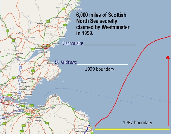
“The Scots” don’t exist yet in this context. Organs of the British State (of which they are part) set monetary and fiscal policy, engage in fiscal transfers throughout the State and are the lender of last resort and ultimately stand behind all the banks in the State. You’ll note that the Scottish government didn’t bail out RBS (actually, does anyone know what the plan is in terms of regulating and being lender of last resort to RBS if there is a Yes vote?). The point is that they can effectively print money to do this, something an independent Scottish government couldn’t do if they were trying to use the currency of another State. I’d take the whole question a lot more seriously if they were proposing to launch their own currency - this proposal is lunacy. Anyway, Krugman says it better than me.
http://www.nytimes.com/2014/09/08/opinion/paul-krugman-scots-what-the-heck.html?smid=fb-share&_r=0
There is talk of Her Majesty intervening with some MPs imploring her to make a speech setting out the benefit of the union. I would have thought that would have been straying offside but seemingly she has done something similar on a previous occasion (1977). The prevailing view does still seem to be that it would be inappropriate and HM herself absolutely does not want to do it. In any case that rabble rouser Salmond has stated that she’ll still be head of State in Scotland regardless of the outcome and can keep all the castles.
Congratulations to the Duke and Duchess of Cambridge on the splendid news that they imparted yesterday. Well said to the Duke though for imploring us all not to focus too much on their news and instead for the time being focus on the big things happening domestically and internationally. A non too subtle hint – I trust it has not gone unheard up in Edinburgh
the Scots will never leave us, they are full of wind and piss, when it comes down to it, they know what side is paying their dole money
It’s quite unedifying watching the English grovel to the Scots and beg them to stay in the union. For years we’ve listened to the English say the Scots were a drain on their resources. The panic sweeping through the cesspit that is Westminster, and the sight of the leaders of the the three main parties abandoning PM’s questions to fly up to Scotland tells a very different story.
The union needs Scotland far more than Scotland needs it. I hope the Scots hold their nerve, every dirty trick in the book will be used by the Unionists in the next week or so.
barstooler alert 
[QUOTE=“braz83, post: 1014022, member: 390”]Krugman hit the nail on the head today. Anyone who willingly votes for some form of currency union without political union in light of what we have seen in the eurozone in the last few years needs their head examined.[/QUOTE]I’d be very surprised if it is anything less than 60% no, the sweaties like to talk a big game but when it comes down to it, the money will win, they’ll shit themselves in the polling booth when they realise they could have no money for deep fried pizzas and cheap lager
Scotland will be free pal and there’s nothing you and your chums in the Bullingdon club can fucking do about it.
braveheart here :D, i’ll ram those words down your throat next week you Irish cunt
I’ll fucking beam you up to your beloved Maggie next week you tory tosspot